Norway is Mecca for Outdoor enthusiasts. My first hike in Norway was Preikestolen and it felt like love at first sight, since that day, I have done a lot of hiking in Norway, and visited the country almost every year whether it was only for a fun weekend in the mountains or a week in the Cold Arctic circle.
There are so many hikes and trails to choose from, the wild camping offers you an opportunity to camp anywhere in the mountains (public property) which gives you an opportunity to go deep into the National Parks without any crowds or tourists.
Here in this blog, I have compiled a list of 8 best places to hike in Norway. I have also compiled a map for you to easily find the location of these hikes.
Best Hikes in Norway Map
1. Segla & Hesten Peak
Far north deep inside the Arctic Circle between Tromso and Lofoten is the island of Senja and the iconic Segla mountain rising above the small village of Fjordgard overlooking fjords. The island is spectacular and the hike to Segla is on the highlight on the island, but for the best views of Segla hike to neighbouring Hesten mountain.
- Distance: 5 km
- Height: 639m
- Difficulty: Strenuous
- Duration: 3 to 4 hours
- Location: Fjordgård, Senja
2. Trolltunga Hike
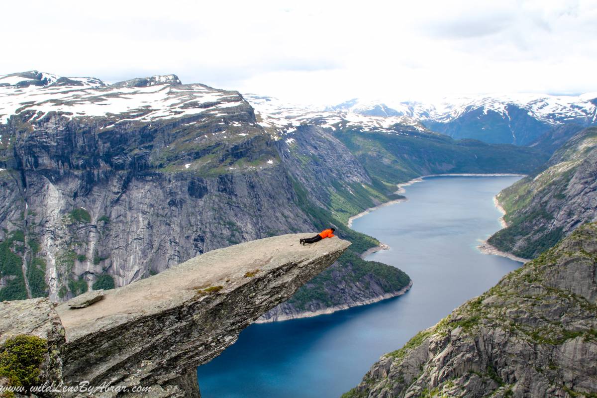
Trolltunga is one of the most spectacular rock formations situated about 1,100m above sea level. It is horizontally out from the mountain, into free air about 700m above the lake Ringedalsvatnet.
It is one of the most popular treks and a national icon of Norway. More than 80,000 people in a season go there for hiking and wait patiently in the queque to take pictures on the rock.
- Distance: 28 km round trip
- Height: 700meters
- Difficulty: Strenuous
- Duration: 10 to 12 hours
- Location: Odda, Hordaland
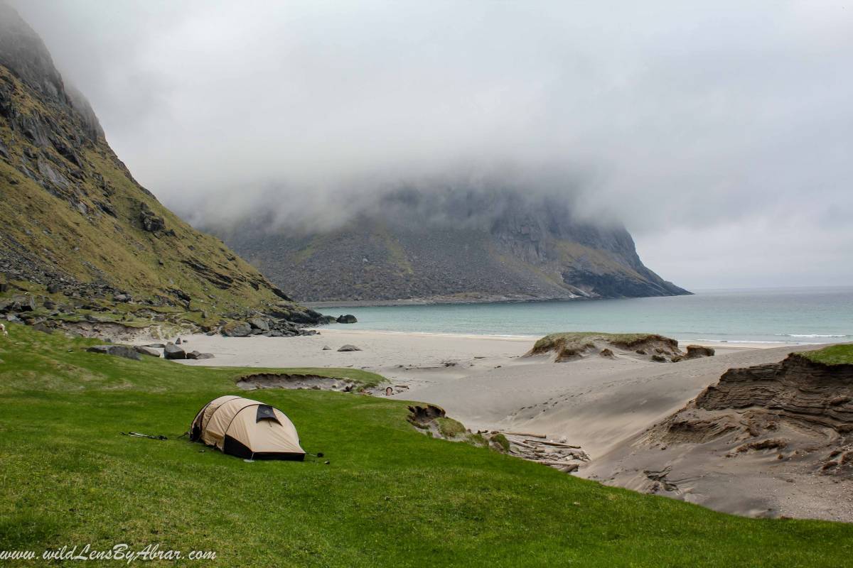
3. Ryten and Kvalvika Beach
One of the most beautiful beach in Lofoten on the northern side of Moskenesøy, where peaks rise vertically hundreds of meters from the sea and waves crash on the golden sand of the beach. It is an easy, fun hike and usually combined with a slightly strenuous hike to the neighbouring Ryten peak offering spectacular vistas of the beach, mountains and fjord.
There is a trail from Kvalvika beach to climb the Ryten peak.
Ryten Peak:
- Distance: 3.5 km
- Height: 543meters
- Difficulty: Easy
- Duration: 2-3 hours
- Location: FREDVANG, MOSKENESØY, Lofoten
Kvalvika Beach:
- Distance: 2.5 km
- Height: 434meters
- Difficulty: Easy
- Duration: 1 hours
- Location: FREDVANG, MOSKENESØY
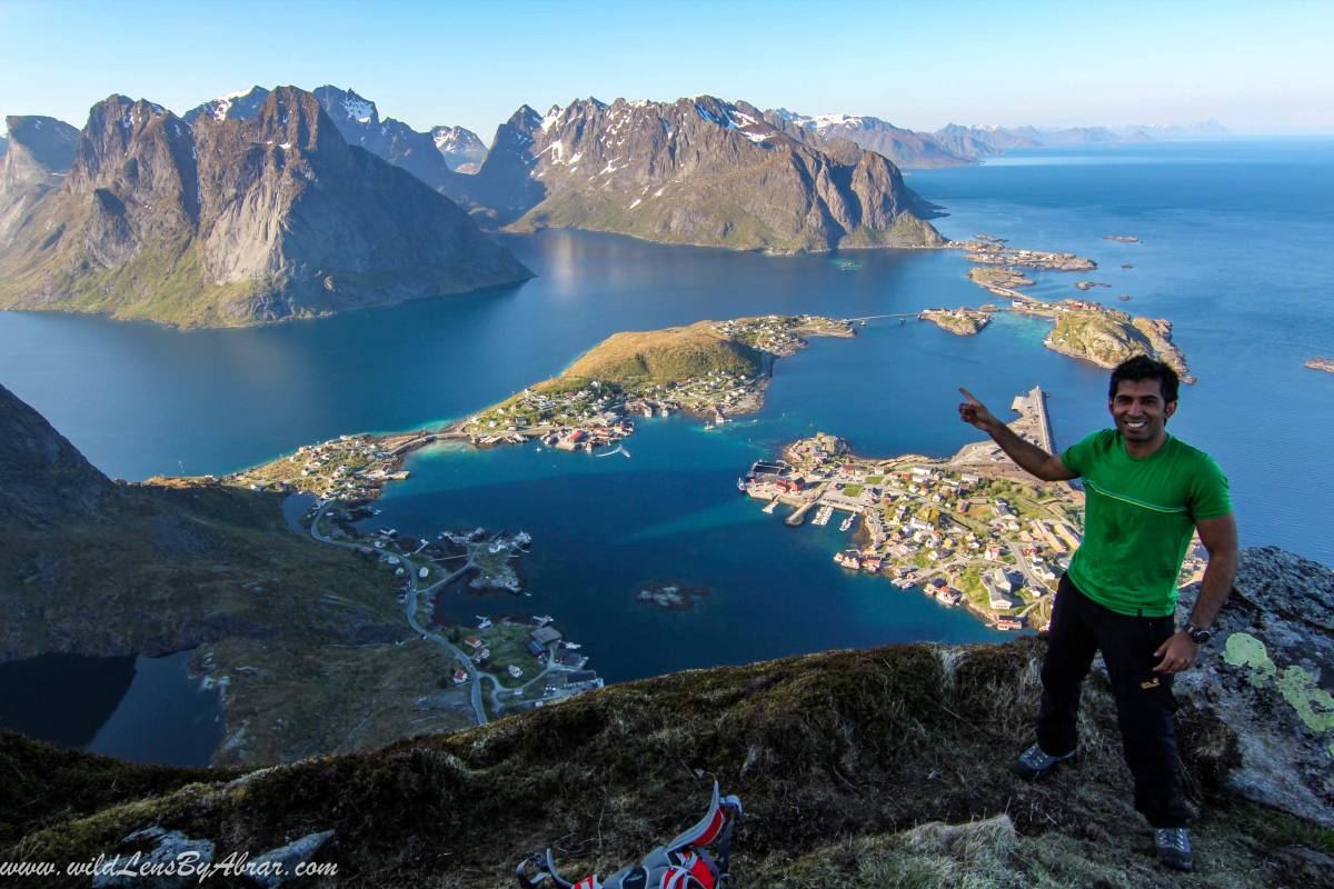
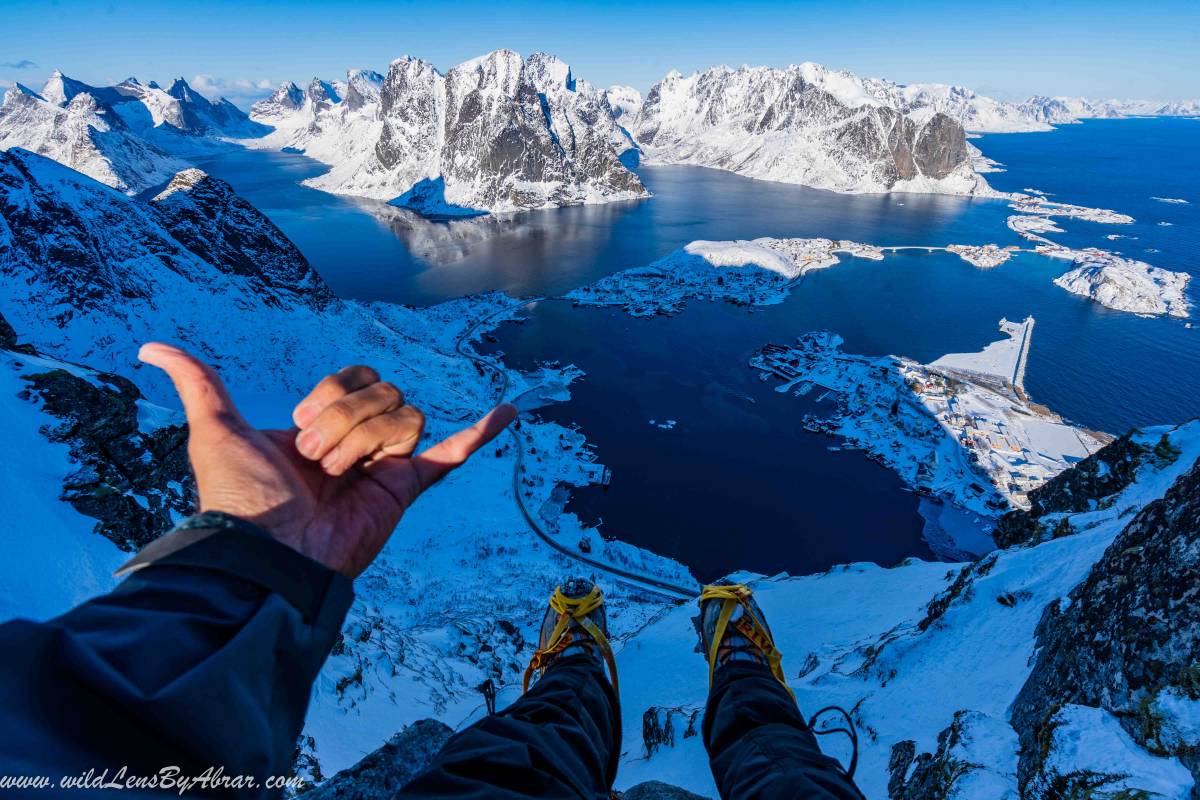
4. Reinebringen Lofoten
It is the most popular hike in Lofoten with Jaw-dropping views over the fishing villages of Sakrivøy, Reine & Hamnøy. The path to Reinebringen is steep and hard. Over the years due to the popularity of the trek, the trail is damaged to an extent that it is now considered dangerous to climb.
The authorities are repairing the trial and sherpa steps are being built, as of March 2019, it is still under construction. Kindly check the status from the village before going up.
- Distance: 3 km
- Height: 448m
- Difficulty: Challenging
- Duration: 3 hours
- Location: Reine, Lofoten
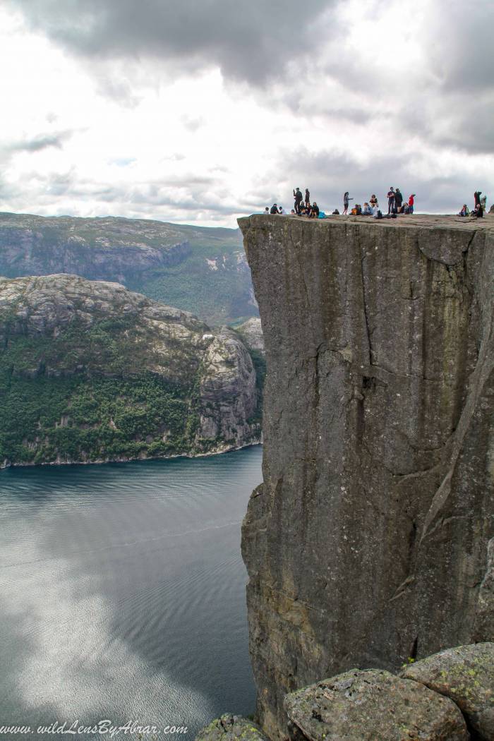
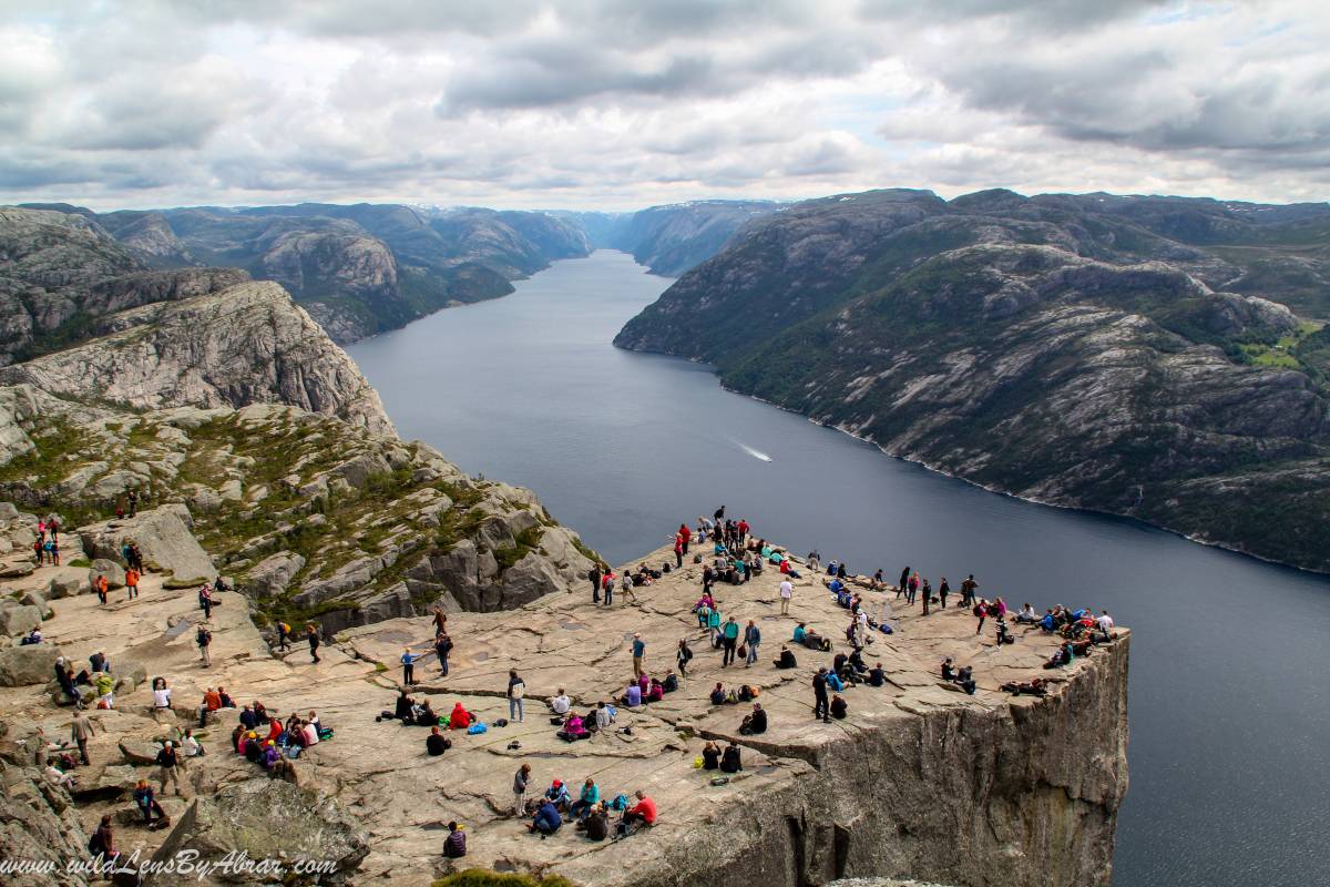
5. Pulpit Rock Hiking Trail
Pulpit Rock hiking trail or the Preikestolen Hike is one of the most popular and relatively easy hikes with spectacular views over Lysefjord. The hiking path is in perfect condition and maintained properly to make this hike suitable for everyone in relatively good physical condition.
- Distance: 8 km
- Height: 604meters
- Difficulty: Easy
- Duration: 5 hours
- Location: Lysefjorden, Rogaland
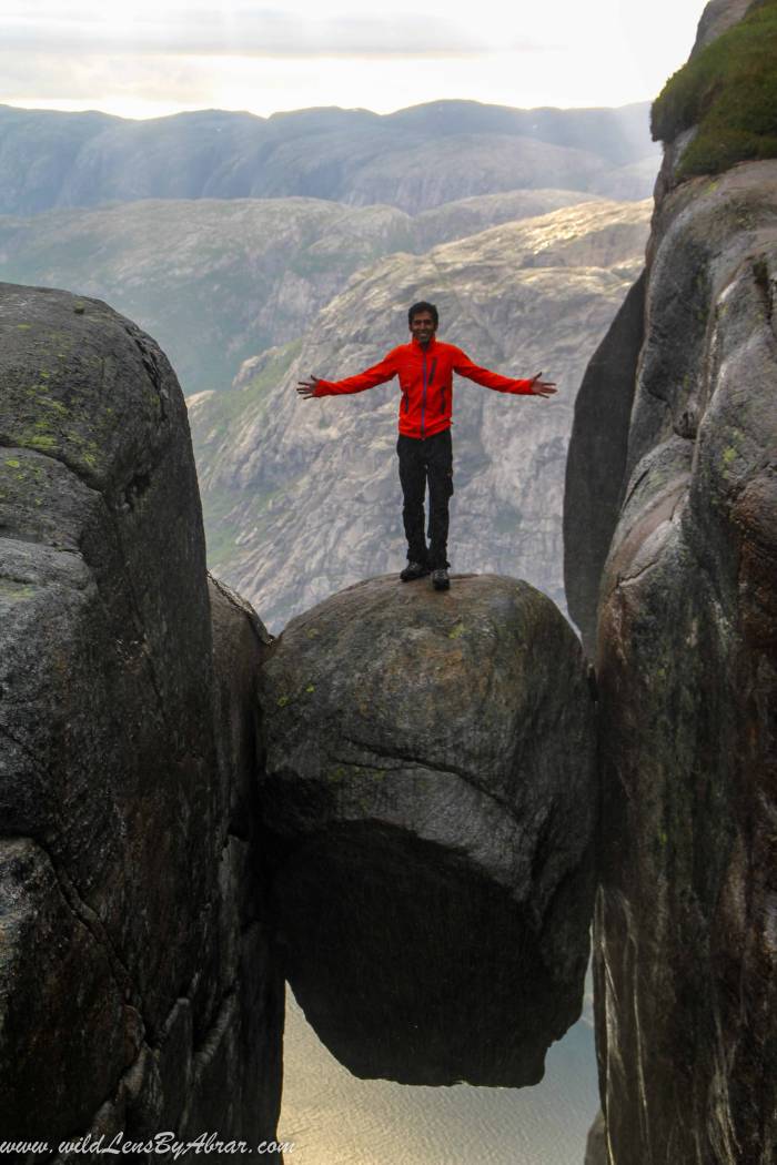
6. Kjeragbolten Hike
You might have already seen the pictures of people standing on a rock stuck in between two ridges and Kjerag is 1110 meters high mountain on the south shore of Lysefjorden. This area is very popular among base jumpers.
- Distance: 12 km (7.5 miles)
- Height: 984meters
- Difficulty: Strenuous
- Duration: 6 to 8 hours
- Location: Lysefjorden, Rogaland
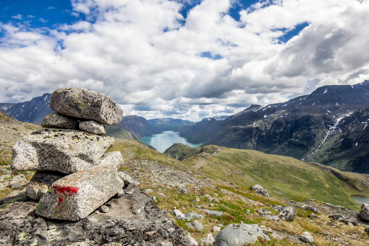
7. Besseggen Ridge Hike
The Besseggen Ridge is located in Jotunheim one the most beautiful National Park in Norway. It is a very popular hike due to its spectacular panoramic views over Jotunheimen's peaks and the two lakes.
There are two cabins of DNT (The Norwegian Trekking Association) along the route offering a great opportunity to stay overnight inside the park and explore the surrounding areas especially if you are not carrying a tent with you.
- Distance: 13 km
- Height: 1373meters
- Difficulty: Strenuous
- Duration: 6-8 hours
- Location: Jotunheim National Park
8. Holandsmelen Hiking Trail
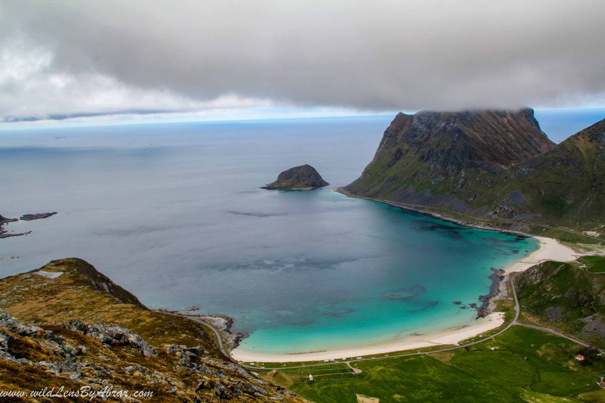
Haukland beach is one of the most beautiful beaches on the islands of Lofoten. There are two mountains Holandsmelen and Mannen Haukland both with spectacular views of Haukland beach. I decided to do Holandsmelen to avoid relatively busy Mannen peak.
- Distance: 2.5 km
- Height: 434meters
- Difficulty: Easy
- Duration: 1 hour
- Location: VIK, VESTVÅGØY, Lofoten