
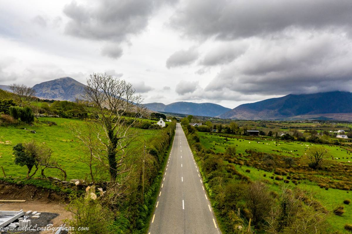
Dingle Peninsula, Ireland's westernmost peninsulas in County Kerry famous for its rugged coastline, ancient sites, mountainous scenery and home to Fungie Dolphin. Dingle Peninsula is named after its only town Dingle and is home to Mount Brandon, Ireland's second-highest peak. This is Ireland at its best, National Geographic once called it "the most beautiful place on earth".
The whole drive is around 50km (30 miles) and the total drive time is only 2 - 2.5 hours, which makes it the best day trip. The coastline is consists of steep sea-cliffs, sandy beaches and one of Ireland's most colourful town. The following blog is a detailed personal account of the whole drive and contains all the information that you may need on your trip including Dingle Peninsula drive map as well as where to stay in Dingle Peninsula.
Things to See in Dingle Peninsula
We stayed the night in Killarney and the next morning drove over to the Dingle Peninsula. The peninsula offers something for everyone from swimming and surfing in its sandy beaches to hiking in the mountains and listening to the traditional Irish music in colourful Dingle.
Here is a list of some of the things to see in Dingle Peninsula:
- Conor Pass
- Lough Doon
- Slea Head drive
- Dunquin Harbour
- Dingle
- Inch Beach
Dingle Peninsula Drive Map
How to Use This Map: Click the Tab on the Upper left corner of the map to view all places of interest marked in the map. You can show or hide the places by check/uncheck marks. By clicking on the Star in the upper corner next to the name of the map, you can add this map into your Google maps to view it on mobile or computer. It will be saved under "Your Places" under the Menu.
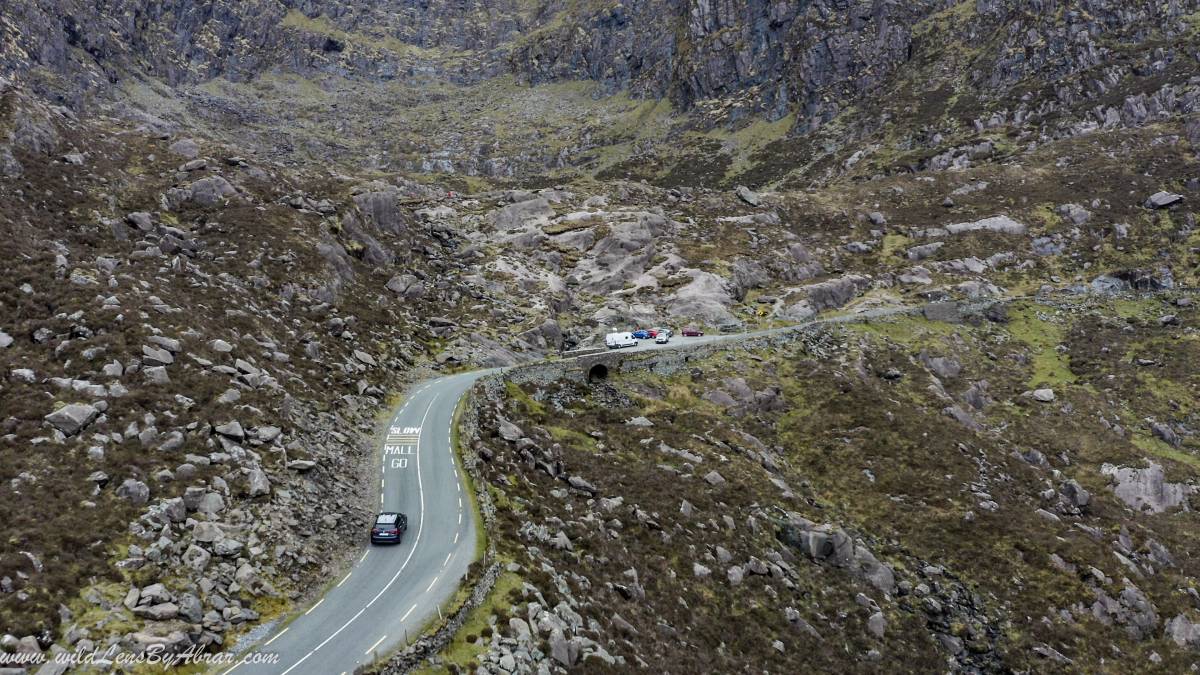
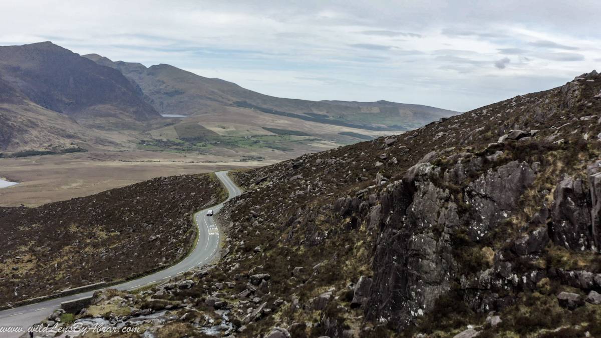
Conor Pass
Conor Pass, the highest mountain pass in Ireland is located on R560 the narrow, curvy and occasionally only one lane asphalt road. While driving to Conor pass, drive carefully as the road on certain points near the pass is one lane periodic passing. You might have to stop and make space for the oncoming traffic from the opposite direction to pass. It is one of the most beautiful drives with incredible vistas of the surrounding mountains and the most scenic way to get to Dingle. There are few designated parking to stop and enjoy the scenery.
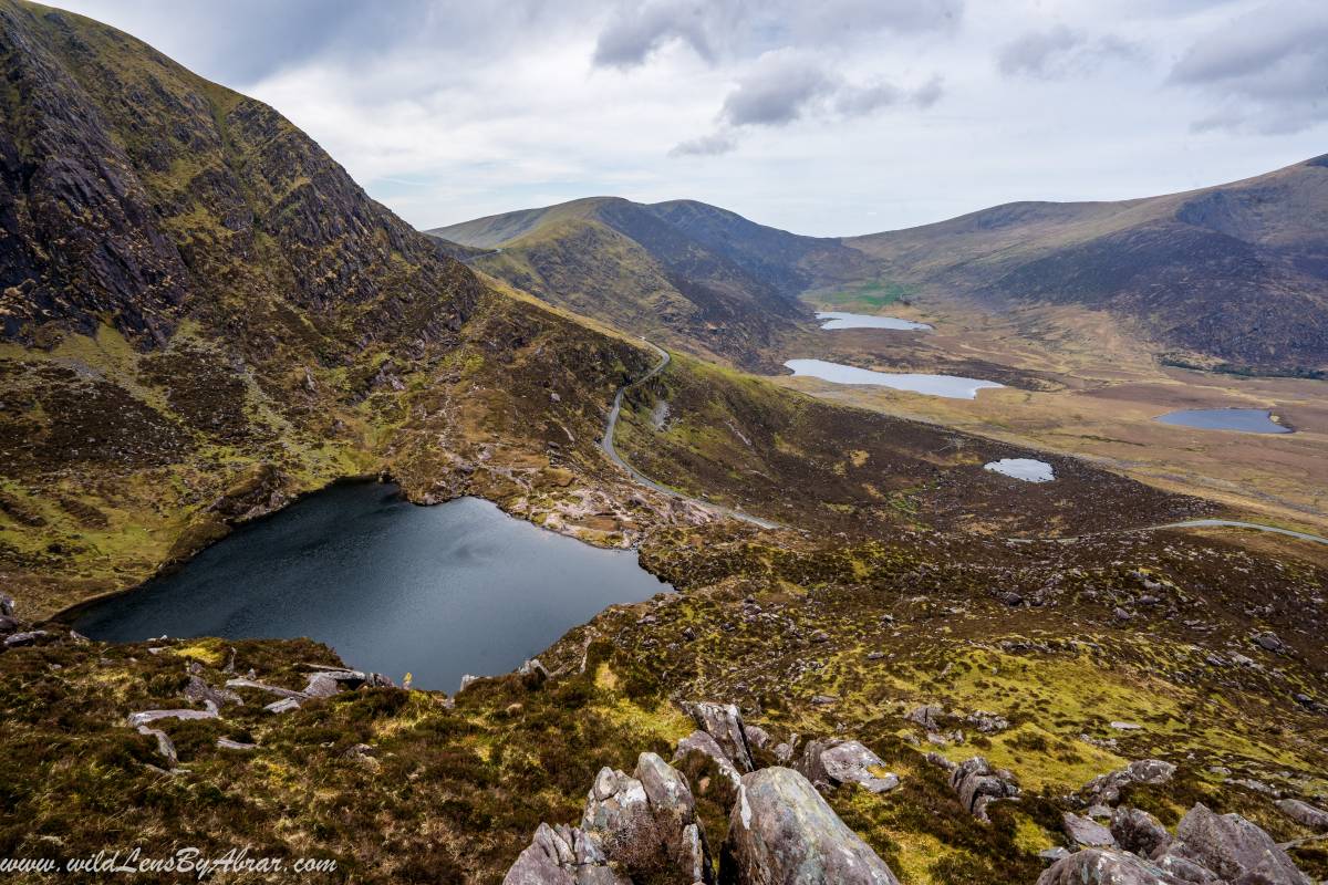
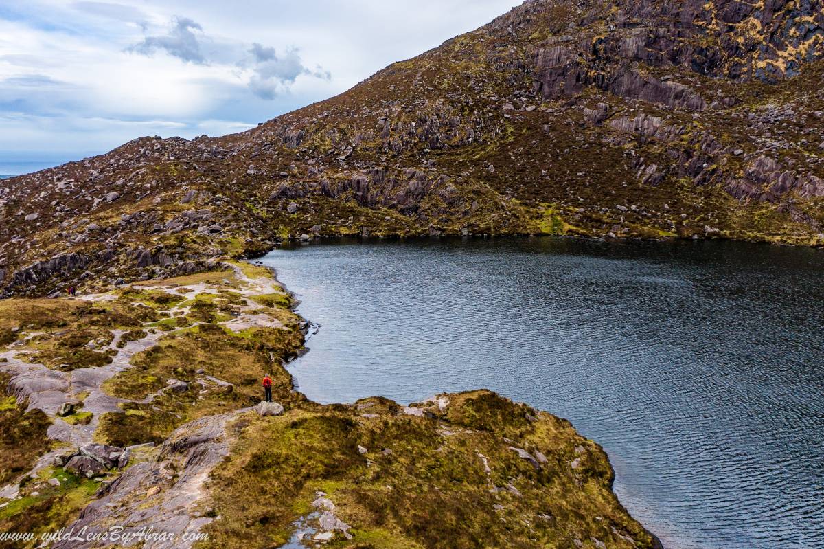
Lough Doon
Lough Doon is a beautiful lake on the way to Conor Pass and a mandatory stop. There is a Parking on the side of the road for up to approx. 10 cars. Usually, visitors stop here for a few minutes without going to the lake which is hidden behind the big rocks and not visible from the parking. The lake is less than a five minutes walk from the parking over the rocks.
There are few hiking opportunities in the area especially the loop around the Lough Doon by climbing to the top of Mountain Coumanare overlooking the lake. Either start from the left or right side of the lake and make a loop. I didn't find any proper path so I just kept climbing up the ridge to the top and came down from the other ridge. It took me 1½ hour to climb up and down the mountain to complete the loop around the Lough Doon.
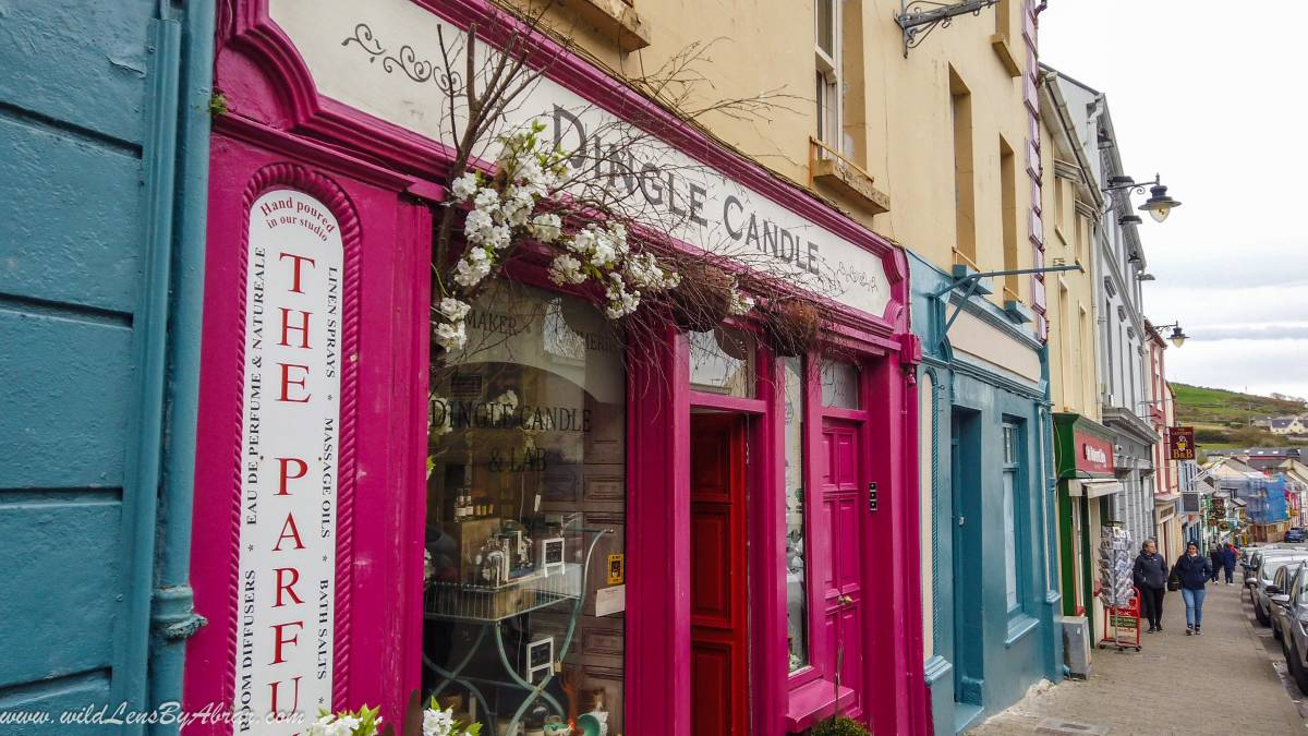
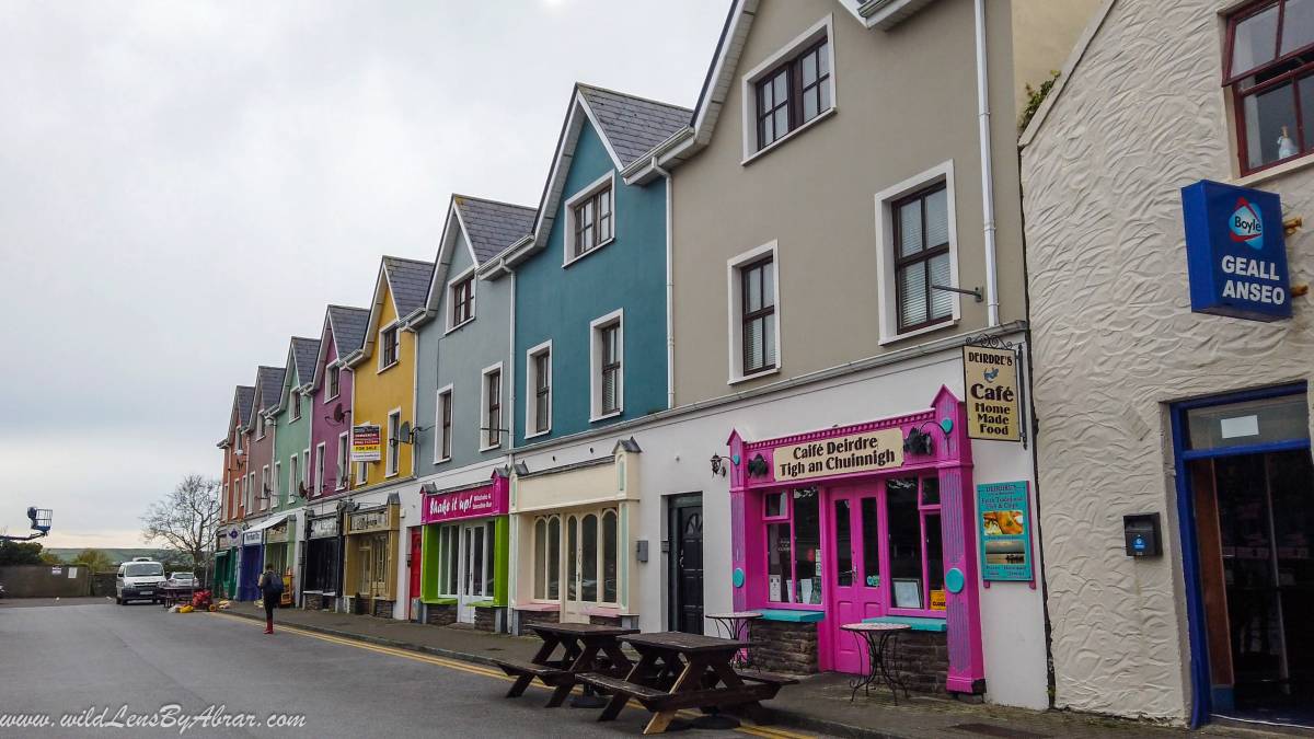
Dingle
The only town in Dingle Penninsula and one of the most colourful towns in Ireland. The town's main road is full of traditional Irish bars playing live music in the evenings and restaurants serves all kinds of food.
Fungie, also known as Dingle Dolphin, live in the waters of Dingle Peninsula and is a very popular boat tour. If you are interested in doing any of the tours then visit Dingle Harbour, there you will find information about all the tours. Fungie Dolphin tour is very popular and should be booked at least one day in advance.
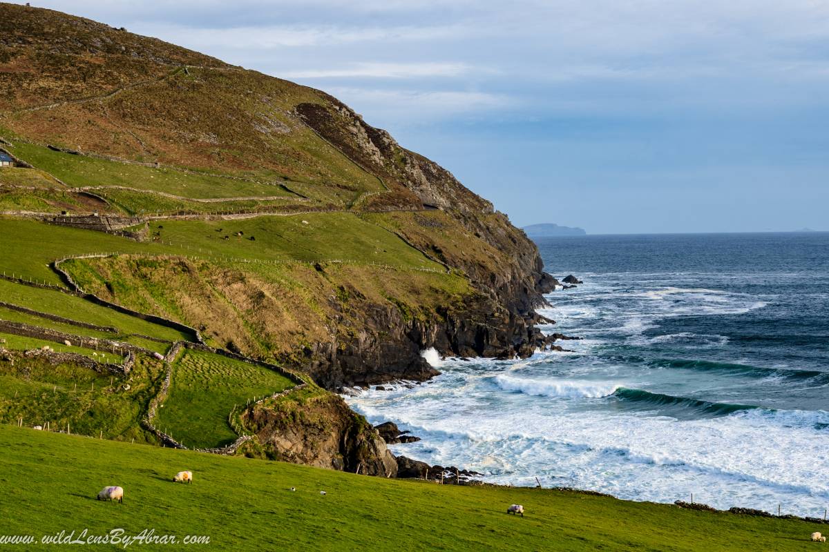
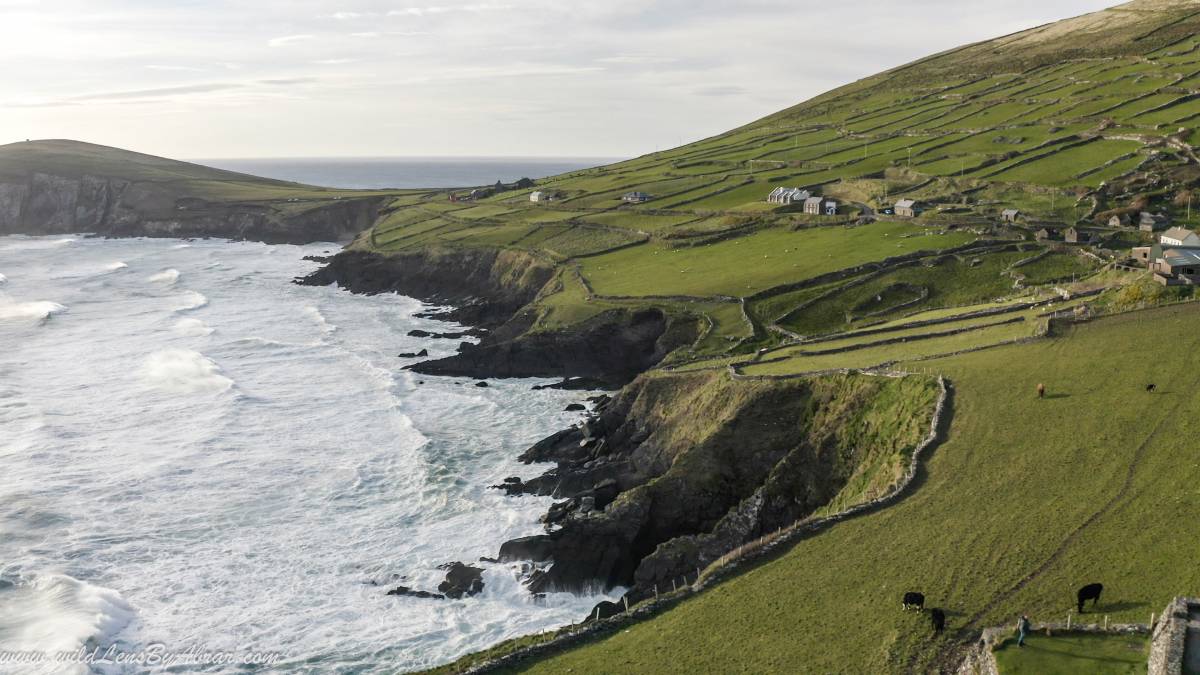
Slea Head Drive (Slay Head Drive)
Slea Head Drive is a 30km long circular route along the spectacular wild Atlantic coast of Dingle, starting and ending in Dingle. There are many worth taking stops along the route, the first one should be at Beehive Hut. Beehive hut is a dry stone hut which you will find only in the Southwest of Ireland, most of these are on Michael Skellig. Parts of the 2017 Star Wars (The Last Jedi) was filmed using the beehive hut on Michael Skellig.
The next stop has to be the Slea Head Drive viewpoint. From here you have the views over to the remote Great Blasket Island and Coumeenole Beach. The day we visited it was so windy the Coumeenoole beach was washed away due to high waves crashing against the rocks.
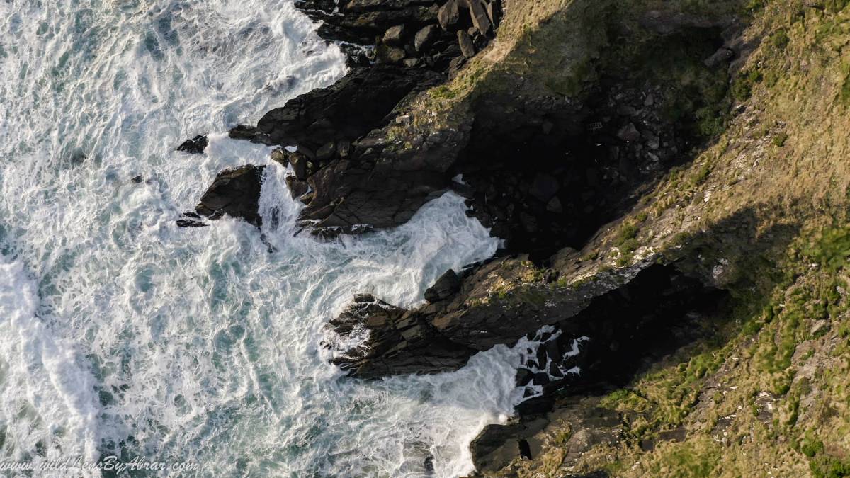
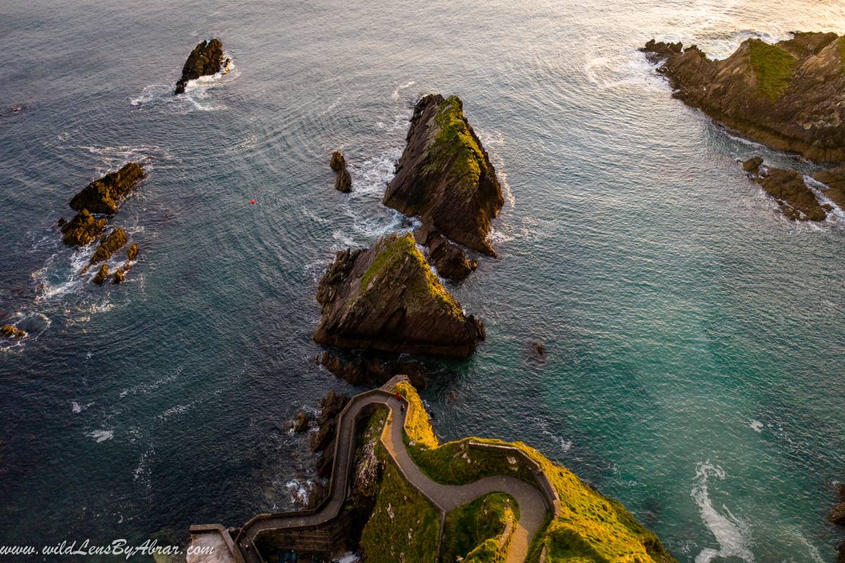
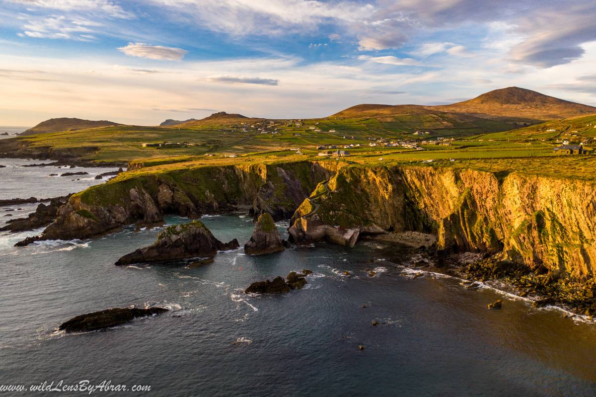
Dunquin Harbour
Dunquin Harbour is another gem on the Dingle Peninsula and my favourite place. Dunquin Harbour Pier can't be seen from the road, a small road turning left to the coast leads to the pier. It is less than 10 minutes drive from the Slea Head viewpoint. The ferries to the Great Blasket Island depart from the pier. More information about the ferries to Great Blasket Island can be found on this Website.
It is one of the most beautiful places for photography, especially at sunset. There are few spots above the Harbour or to the left side of the cliffs overlooking the Pier.
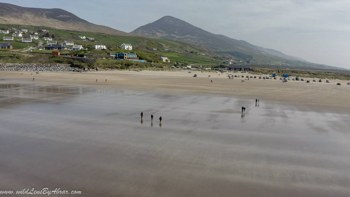
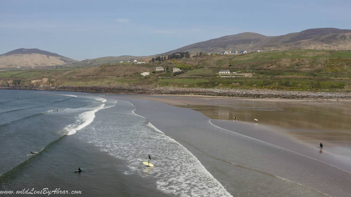
Inch Beach
This 5 km long beach in the Dingle Peninsula is a very popular spot for surfing, kayaking, windsurfing, kite surfing, and Fishing. The water is very cold and if you are not afraid of swimming in cold waters then give a try or just enjoy a nice walk along the beach like us.
Where to Stay in Dingle Peninsula
We spent the night in Dingle in an Airbnb. There are a number of Hotels and Hostels in Dingle so choose the one you like the most. Dingle Peninsula can be seen in one full day so if you have limited time you can do a day trip from Killarney but its better to stay at least one night in Dingle.