
Gjogv, an Idyllic village famous for 200 meters long sea-filled gorge is one of the most beautiful villages in the Faroe Islands on the northeast of the Eysturoy island. We spent a day driving from the village of Eiði passing Slættaratindur, the tallest mountain on the Faroes, exploring Gjogv and hiking to Ambadalur valley near the Gjogv. This blog is our experience of visiting the village and have all the information you need to know before visiting.
Driving from Eiði to Gjogv
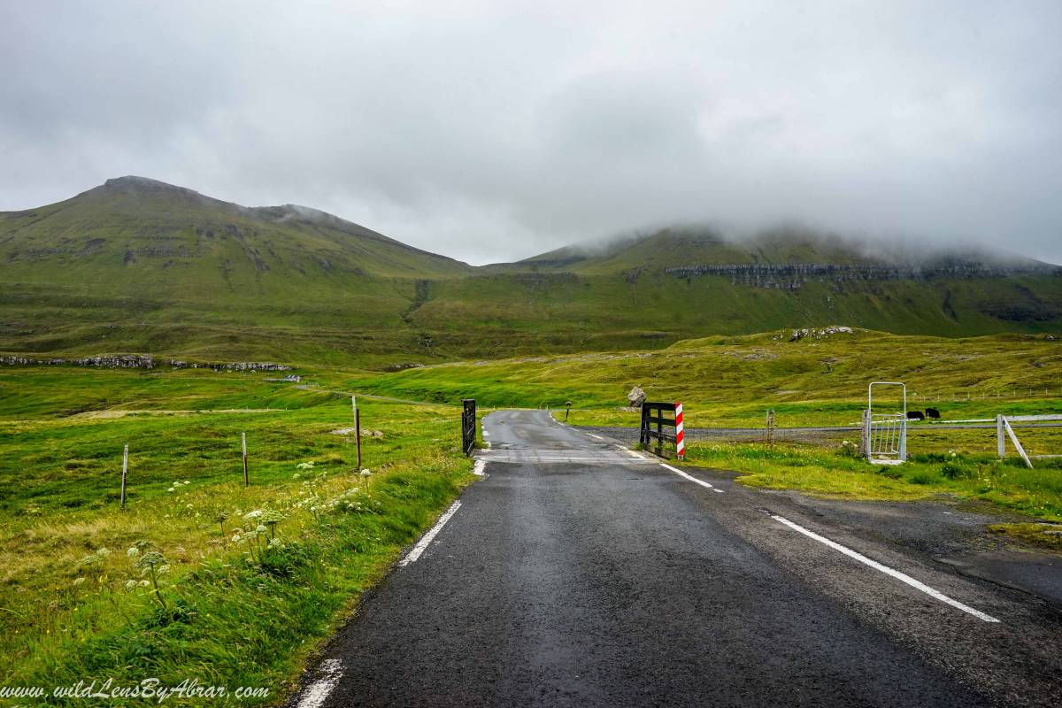
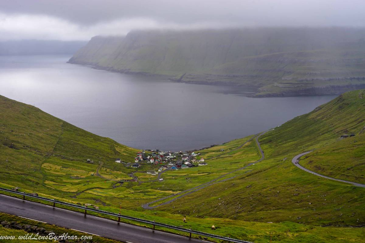
After staying overnight in Eiði at the incredible campsite along the Niðara Vatn lake and the football ground, we drove to Gjogv on a narrow windy road which is considered one of the best drive in the Faroes offering panoramic views of the villages of Eidi and Tjørnuvík on the island of Streymoy. The road climbs up the mountains by gaining sudden elevation, leaving behind the village and disappearing into the fog. The 880-meters Slættaratindur mountain is the highest peak in the Faroe Islands and is visible in good weather conditions. The hiking trail to Slættaratindur starts from the parking along the road and takes 4 hours to complete the hike. Unfortunately, for us, the mountain was covered in thick fog and we couldn't see anything from the parking so we cancelled the plans to hike to Slættaratindur and drove to Gjogv.
Arriving in Gjogv
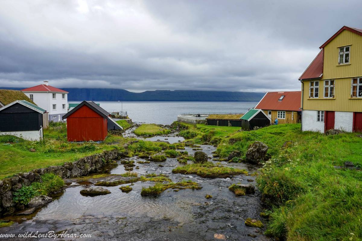
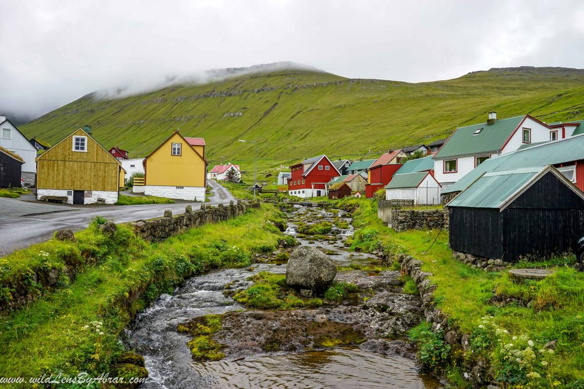
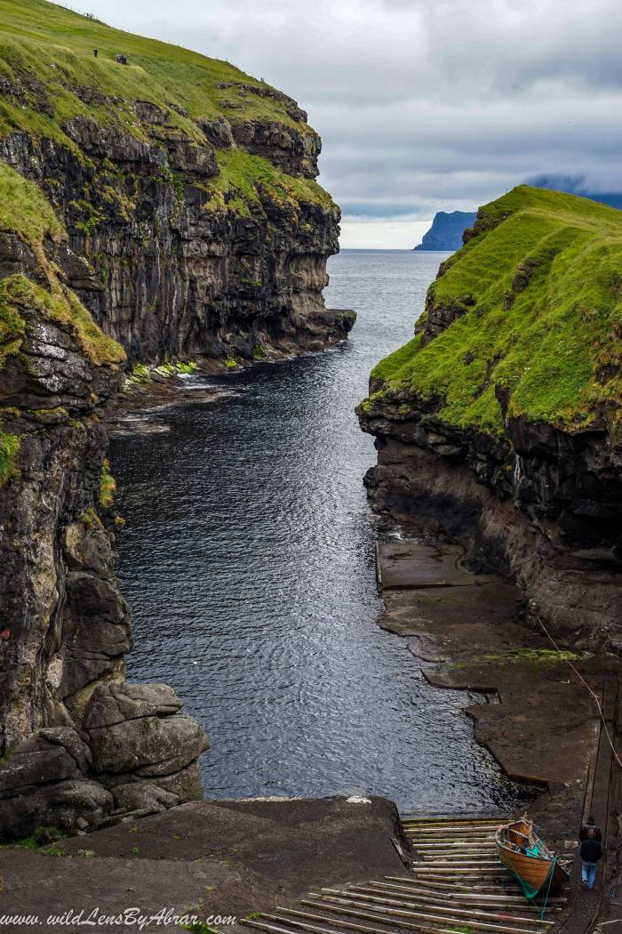
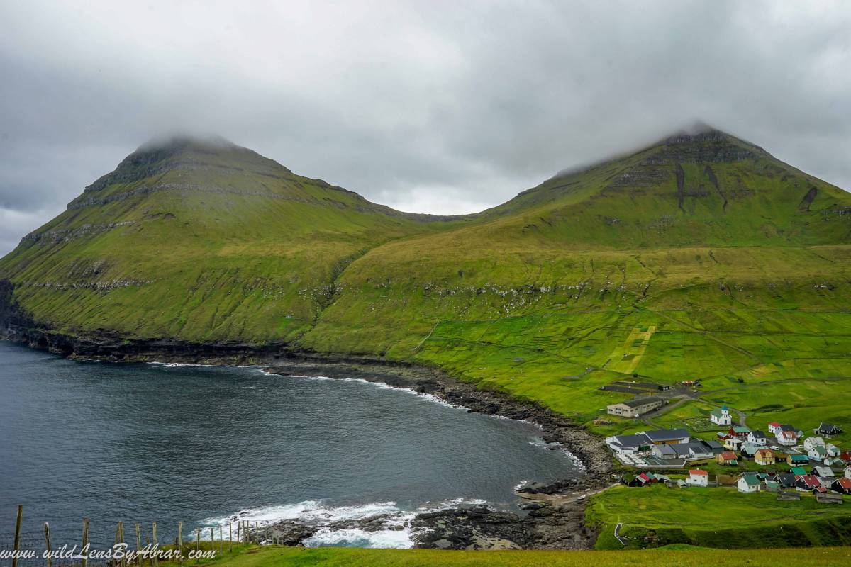
Gjogv in Faroes mean gorge and the village is named after the sea-filled gorge near the village. The village is one of the main tourist attraction in the Faroe Islands, visited by almost every tourist. It is a small quiet village with beautiful colourful houses and a church that dates back to 1929. Upon arriving in the village, drive directly to the small parking near Gjógv Natural Harbor.
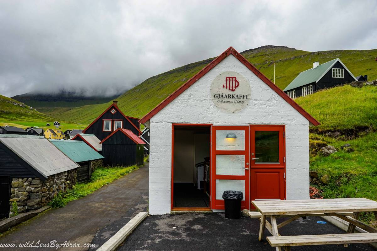
Near the entrance to the gorge is a cute cafe with a nice terrace offering coffee, cakes and drinks etc. From here you can walk down to the gorge.
Hike to Ambadalur
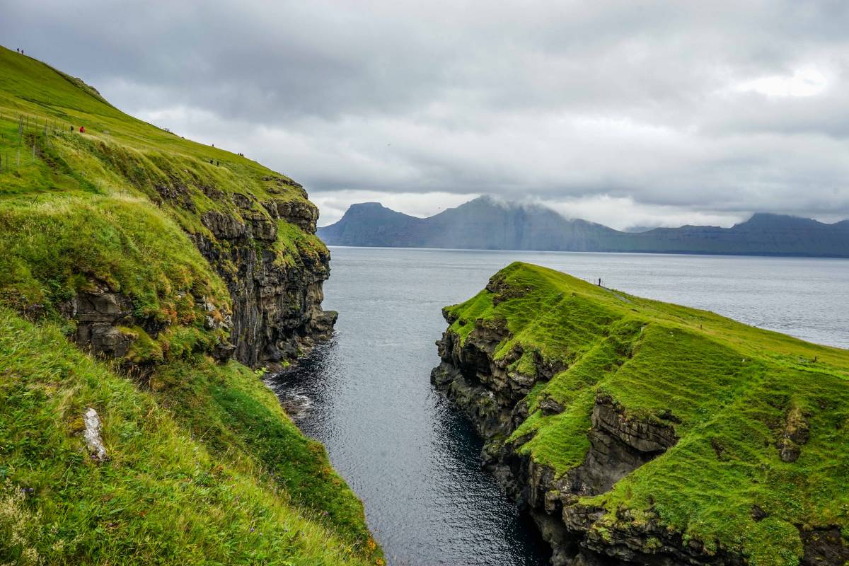
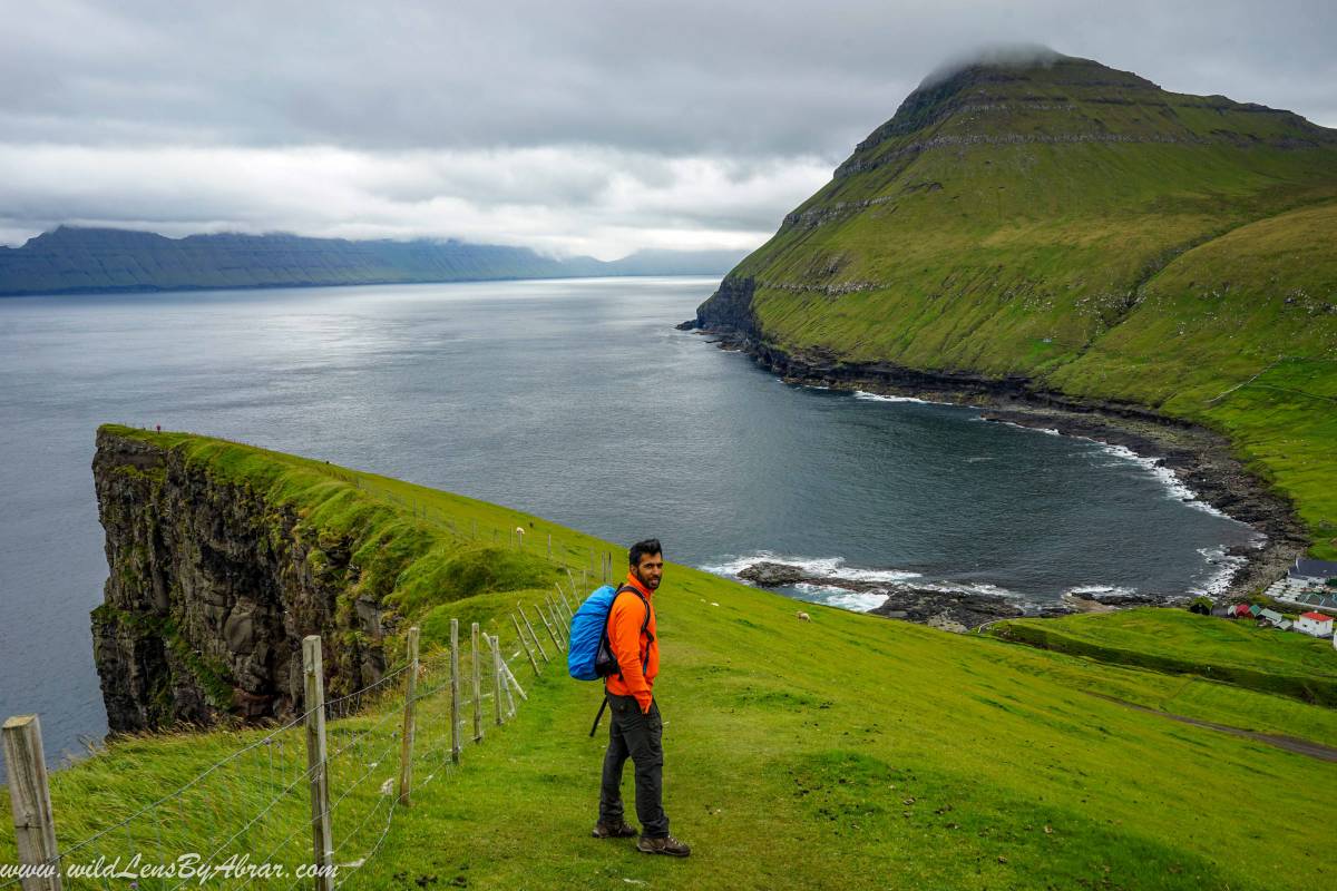
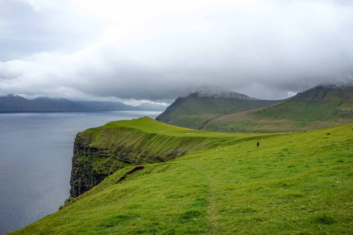
The hike to Ambadalur valley starts from the sea gorge, going over the hill following the dramatic cliffs of the coastline. The hike is relatively easy with wonderful vistas of the village and surrounding mountains.
After exploring the gorge by walking on both sides of it, we continued hiking to Ambadalur, the first section of the hike is steep and the path on some sections is muddy. From the path, there are numerous opportunities to take pictures of the village surrounded by the mountains.
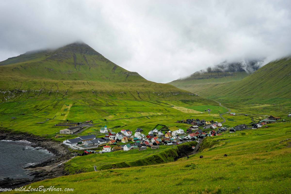
We were making very slow progress and weren't thinking to climb all the way up to the top of the mountain until we finished hiking the first steep section of the path. From here we could see the path going to the top of the peak and decided to continue further to Ambadalur valley.
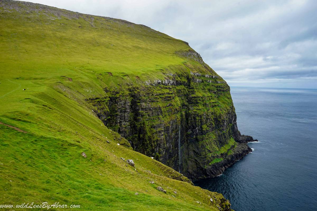
After climbing up the cliff, the path follows along the fence on the edge of the cliff.
we continued hiking along the cliffs, there are fences along the way that keeps the sheep from wandering off. The path is clearly visible and at some points, we weren't paying attention so went off the path a few times but it is easy to find again.
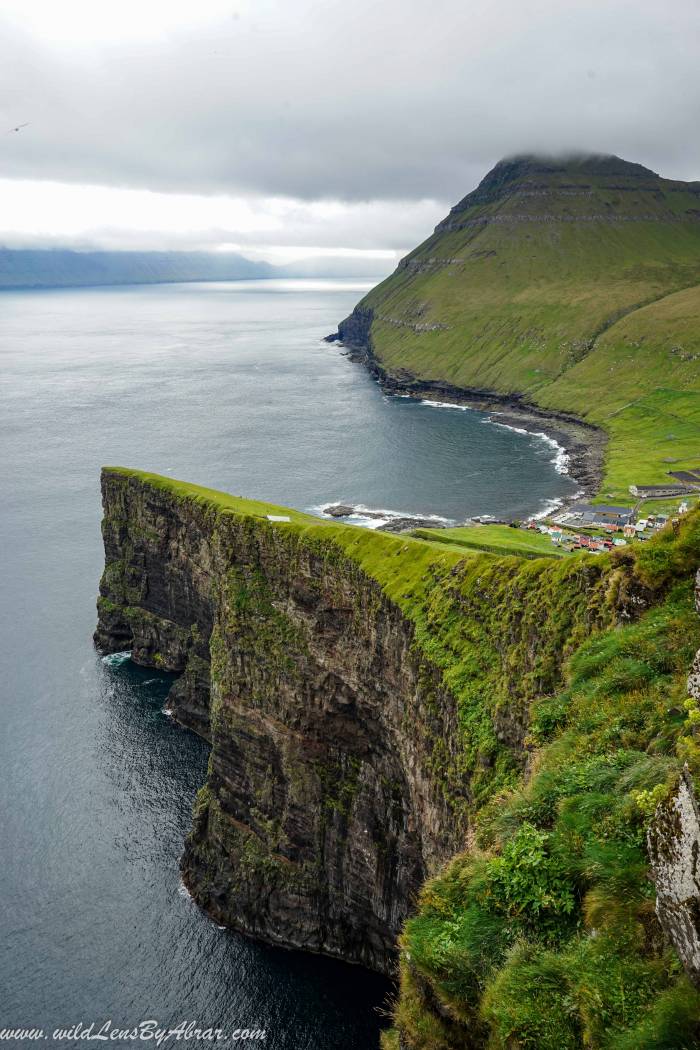
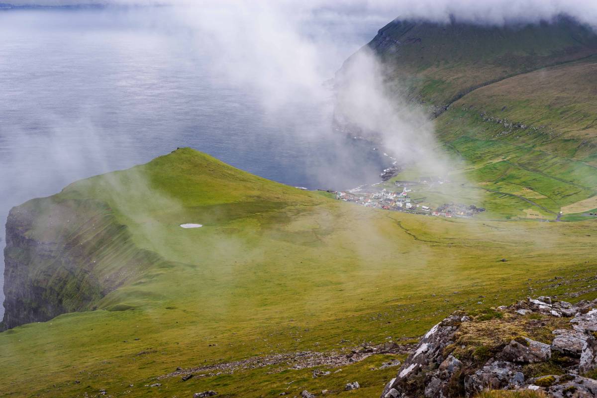
After hiking almost an hour along the cliffs (see the above picture), we decided to leave this path and climb the 469 meters peak of Fjallið overlooking the village and the valley down below.
It took us another 20 minutes to reach the top of the mountain and as we arrived at the top, the fog rolled in so we had to wait for a few minutes for the fog to clear up and take some pictures. It wasn't a planned hike and we didn't bring any food with us which was a big mistake.
We wanted to sit a bit longer at the top but we couldn't resist the temptation to go down and have some food. We headed back by taking some random downhill path before rejoining the path along the cliffs. It took us 2½ hours to complete the hike.

Travel Advice
Start the hike around the gorge in the village and continue by climbing along the cliffs even if you are not in good shape. The hike is absolutely worth doing all the way up to the Fjallið mountain but you can abort anytime you want and don't forget to take something to eat, you might end up climbing all the way.