
The Zugspitze, at 2,962 m above sea level is the highest mountain in Germany near the town of Garmisch-Partenkirchen and runs along the Germany-Austria border. Being on the Austrian-German border, there are possibilities to visit either from Germany or Austria by taking the cable car or hiking one of the five hiking trails.
This blog explains all the possibilities to visit Zugspitze including all the hiking trails and everything that you should know while planning your trip.
How to Use This Map: Click the Tab on the Upper left corner of the map to view all places of interest marked in the map. You can show or hide the places by check/uncheck marks. By clicking on the Star in the upper corner next to the name of the map, you can add this map into your Google maps to view it on mobile or computer. It will be saved under "Your Places" under the Menu.
How to Get There
By Car
Garmisch-Partenkirchen is less than an hour by car from Munich but on weekends and public holidays holidays it can take upto 3 hours.
By Train
Garmisch-Partenkirchen is well connected to the rest of Germany by train. Trains leave from Munich main station every hour and take 80-90 minutes. Check the Deutsch Bahn (German Railway) website for actual schedule and booking.
By Bus
Flixbus have regular buses from Munich leaving every 2 hours. This is the cheaper option and roughly takes the same time as Train if there are no traffic jams. For more information visit Flixbus website.
How to Visit Zugspitze
There are two Cable Cars, Zahnradbahn (Cogwheel train) and five hiking/mountaineering trails from Germany and Austria.
From Germany
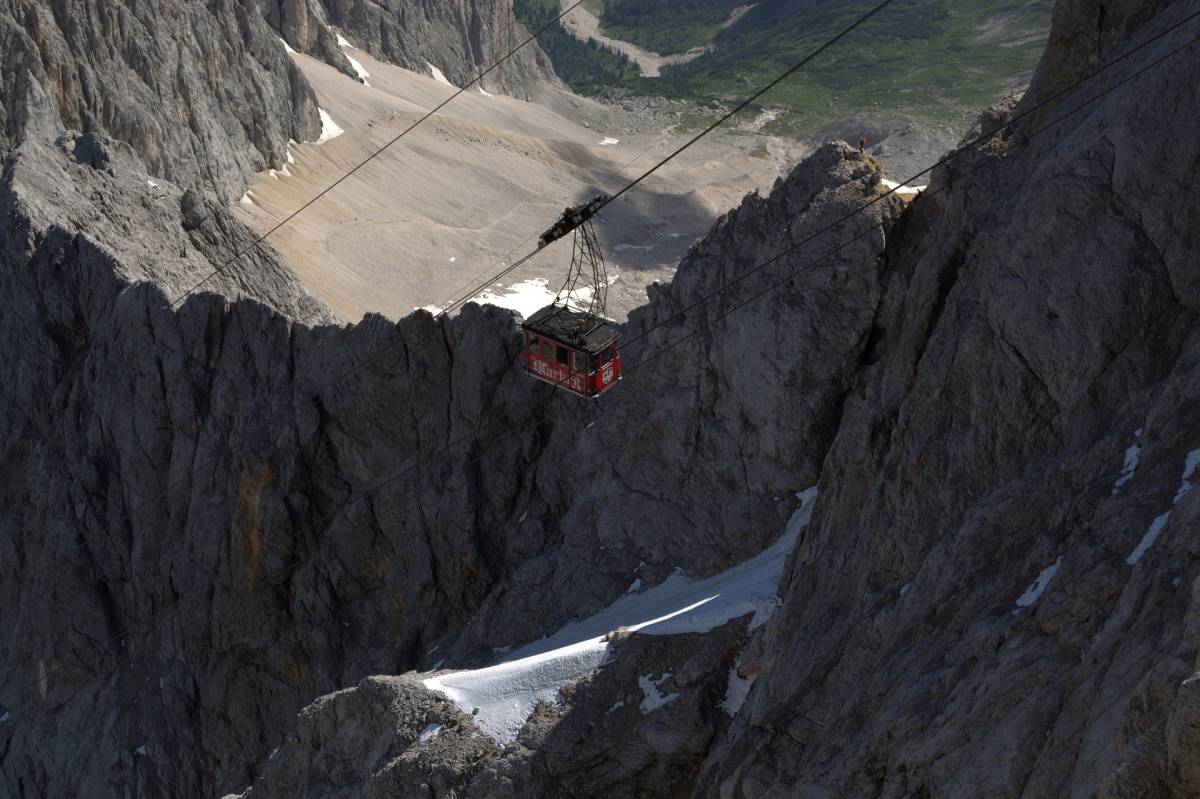
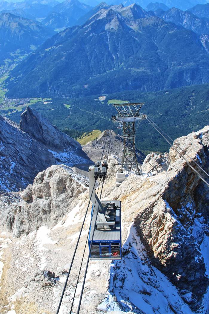
From the German side, there are two options to get to the top of Zugspitze by taking Cable Car or Zahnradbahn (Cogwheel train). The prices are the same, visit their website for actual price information. You are allowed to take Cogwheel train and Cable Car in Zugspitze ticket fare.
Zahnradbahn (Cogwheel Train)
The Zahnradbahn (Cogwheel Train) leaves from the Garmisch-Partenkirchen main train station and is very convenient if you arriving at the train station. It passes through Grainau and Eibsee.
Eibsee Cable Car
The cable car station is near Eibsee, see the above google map for location. It is the most scenic way to get to the top of Zugspitze. Most people take the cable car to the summit and descend via Zahnradbahn (Cogwheel train). This is great to experience both services. The Zahnradbahn (Cogwheel train) has a stop at Eibsee cable car station.
From Austria
Tiroler Zugspitze cable car is in the small village of Obermoos (see the above google map) in the Ehrwald region. It is more suited to those who are travelling by car and it costs little less than the German Zugspitze cable car. For actual prices, visit their Tiroler Zugspitzebahn website.
Zugspitze Hiking Trails
There are in total five hiking trails starting from either Germany or Austria. All the trails have different difficulty level. Please check the weather conditions before attempting any trail.
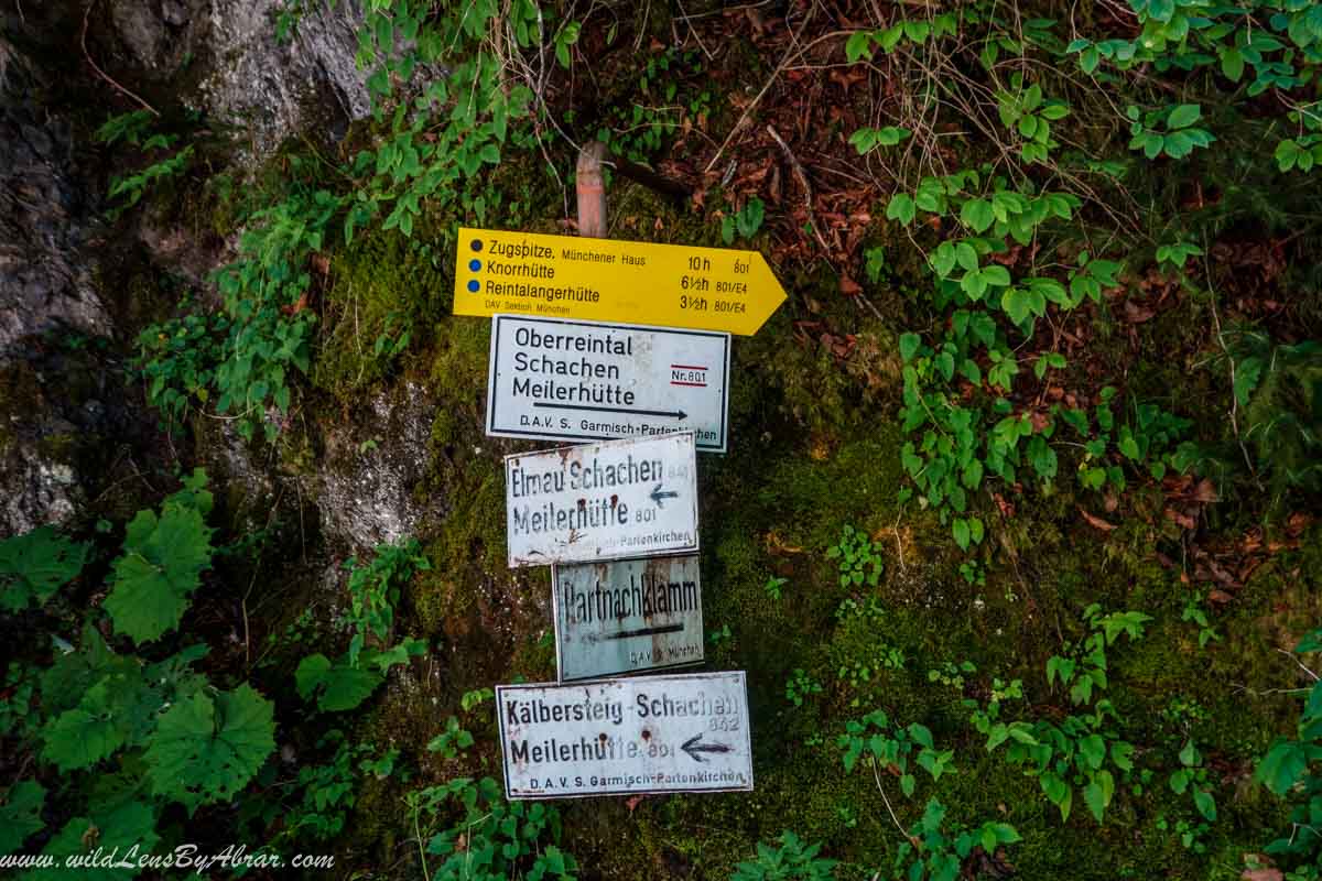
Route 1: Reintal
- Starting point: Garmisch-Partenkirchen
- Distance: 21km
- Time to Ascend:9-10 hours
- Difficulty Level: Easy
- Ascend: 2300 meters
- Technical Climbing: No
- Overnight Possibility: Reintalangerhütte (1370 m), Knorrhütte (2051 m) and Münchner Haus (2959 m)
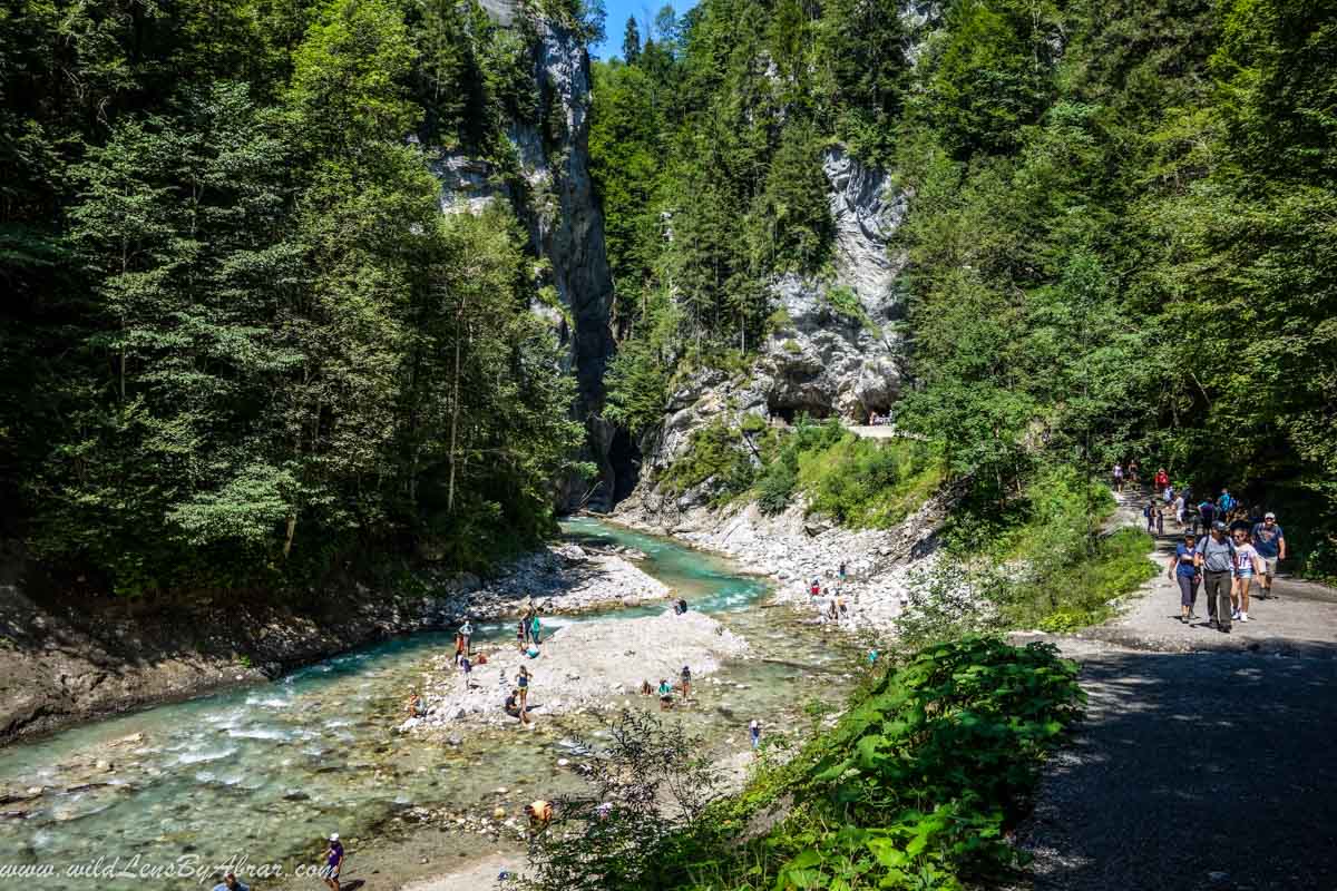
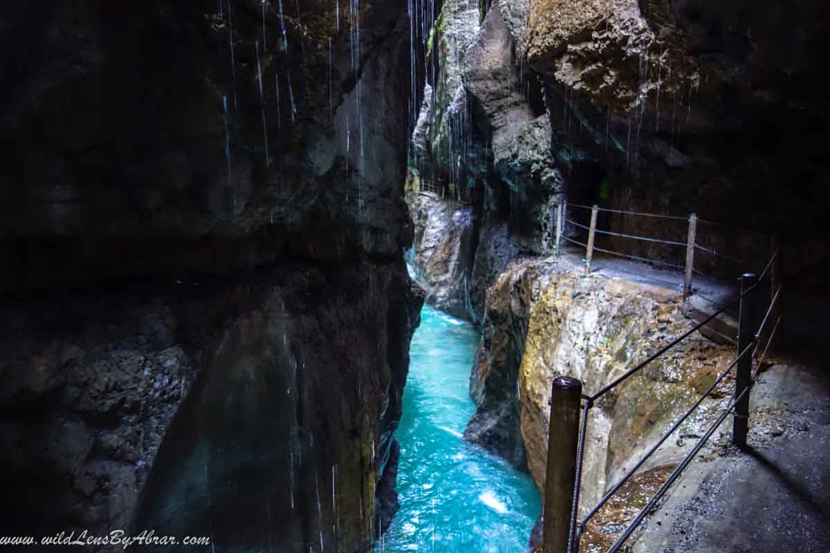
This is one of the longest, easiest and most beautiful trails to get to the summit of Zugspitze through the Reintal (Rein valley). Except for the final climb, there is hardly any technically difficult part on this route. Nevertheless, it should not be underestimated, as the trail is very long. The starting point is the Ski Stadium in Garmisch-Partenkirchen (730 m). The trail leads through the impressive Partnachklamm (Partnach Gorge) and slowly rises to the Reintalangerhütte. From the hut, it goes uphill to Knorrhütte. You can stay overnight one of the two mountain huts along the way and Münchner Haus which is a couple of meters below the summit.
In case of bad weather at Zuspitzplatt, there is a possibility to take a cable car at Sonn-Alpin (Sonnenkar).
Route 2: Ehrwalder Alm and Gatterl
- Starting point: Ehrwald
- Distance: 14 km
- Time to Ascend: 7-8 hours
- Difficulty Level: Medium
- Ascend: 2100 meters
- Technical Climbing: No
- Overnight Possibility: Knorrhütte (2051 m) and Münchner Haus (2959 m)
The trail starts from Ehrwald over the Gatterlroute to Knorrhütte where it will join the Reintal trail and follows the same path. This trail can be shortened by taking the Ehrwalder Almbahn cable car. Similar to the Reintal trail, there is a possibility to stay overnight at Knorrhütte.
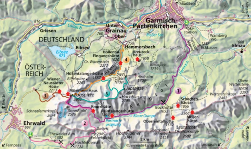
Route 3: Austrian Snow Cirque
- Starting point: Eibsee or Obermoos
- Distance: 8km from Eibsee and 5km from Obermoos
- Time to Ascend: 8 hours
- Difficulty Level: Medium
- Ascend: 2015 meters from Eibsee and 1735meters from Obermoos
- Technical Climbing: No
- Overnight Possibility: Wiener-Neustädter Hütte (2209 m) and Münchner Haus (2959 m)
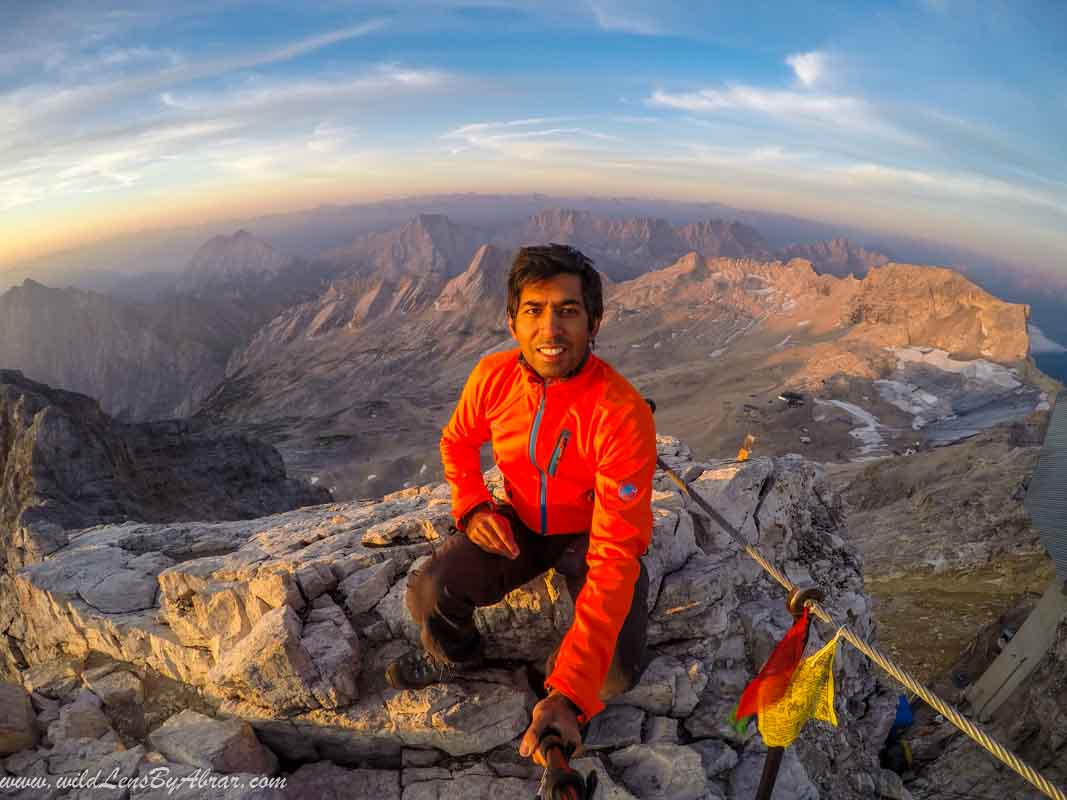
This trail can either be started from Eibsee, Germany or from Obermoos, Austria. Both trails join on the Austrian side and climb up to Wiener-Neustädter Hütte. From here to the summit, you need to be careful about the falling rocks. I myself climbed Zugspitze by taking this trail and I have included some pictures below in this blog to give you a better understanding of the trail.
Route 4: Höllental (Devil's Valley)
- Starting point: Hammersbach
- Distance: 9 km
- Time to Ascend: 10 hours
- Difficulty Level: Difficult
- Ascend: 2200 meters
- Technical Climbing: Yes (Helmet, Harness and for crossing the glacier crampons are necessary)
- Overnight Possibility: Höllentalangehütte (1387 m) and Münchner Haus (2959 m)
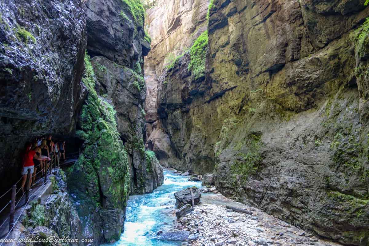
The Höllentall trail is the most popular and has the most diverse mountain scenery. The trail starts in Hammersbach and passes through the spectacular Höllentalklamm (Höllental Gorge). After the Gorge, is the Höllentalangehütte where you have the possibility to stay overnight. To cross the small Glacier section known as Höllentalferner, you need Crampons and usually, the rope is not required.
Route 5: Jubilee Ridge
- Starting point: Ostfelderkopf
- Distance: 8km
- Time to Ascend: 10 hours
- Difficulty Level: Difficult
- Ascend: 2015 meters
- Technical Climbing: Yes (Helmet and Harness is required)
- Overnight Possibility: Münchner Haus (2959 m)
The Jubilee Ridge is the best known and longest ridge routes in the Eastern Alps. The route ends at Grießkarscharte (2463 m). From there you either climb over the Matheisenkar into Höllental or continue to Alpspitze (2628 m) and descends via the Nordwandferrata to the mountain station of the Alpspitzbahn at Osterfelderkopf (2050 m). The tour is not a via Ferrata, it has many not secured passages in II. To III. Please note along the route, there is no water, so take sufficient drinking water with you.
Hiking to Zugspitze - My Experience
Route 3: Austrian Snow Cirque From Eibsee
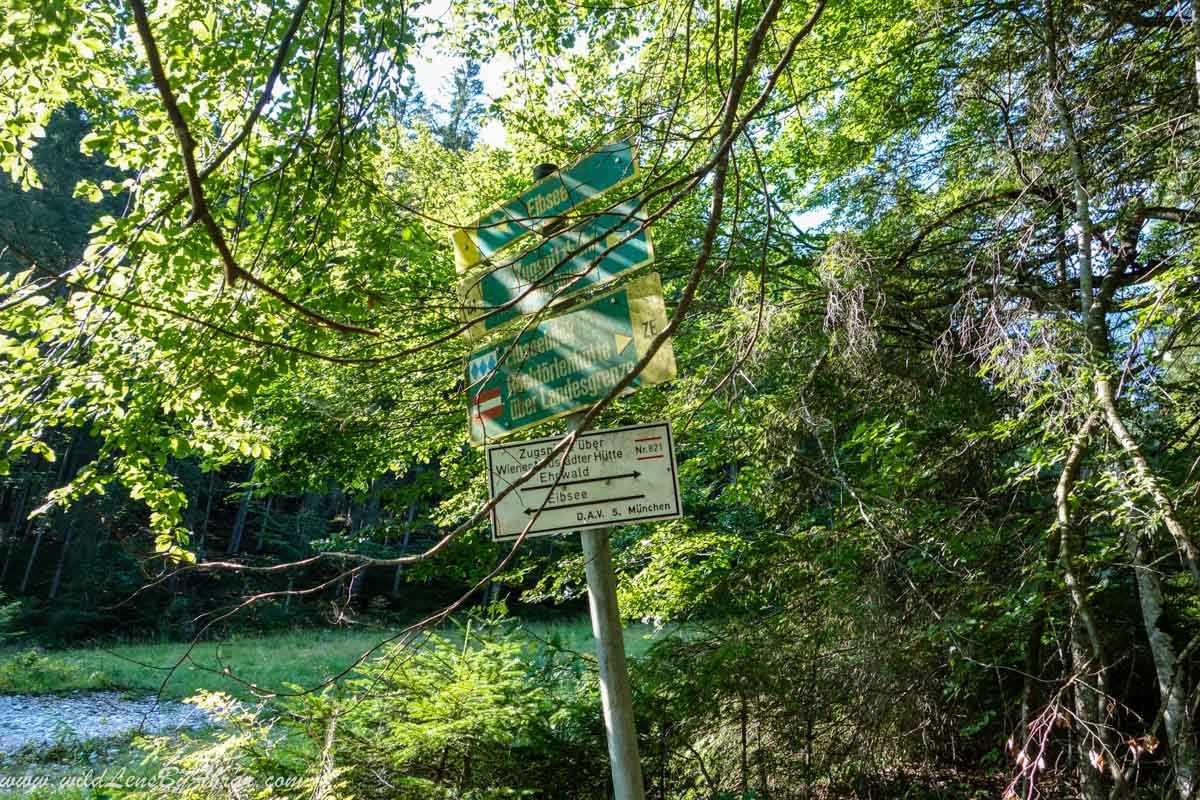
I decided to take this trail due to its difficulty level and also being one of the shortest trails compared to other hiking trails. I parked my car at the Eibsee cable car Parking lot. The trail starts from the parking lot and continues towards the Austrian border. The first section of the trail is through the forest and slowly gains elevation. It is well-trodden and marked all along the way. Please, follow the trail marked as Zugspitze über Wiener-Städter hütte (Nr. 821) see the below picture.
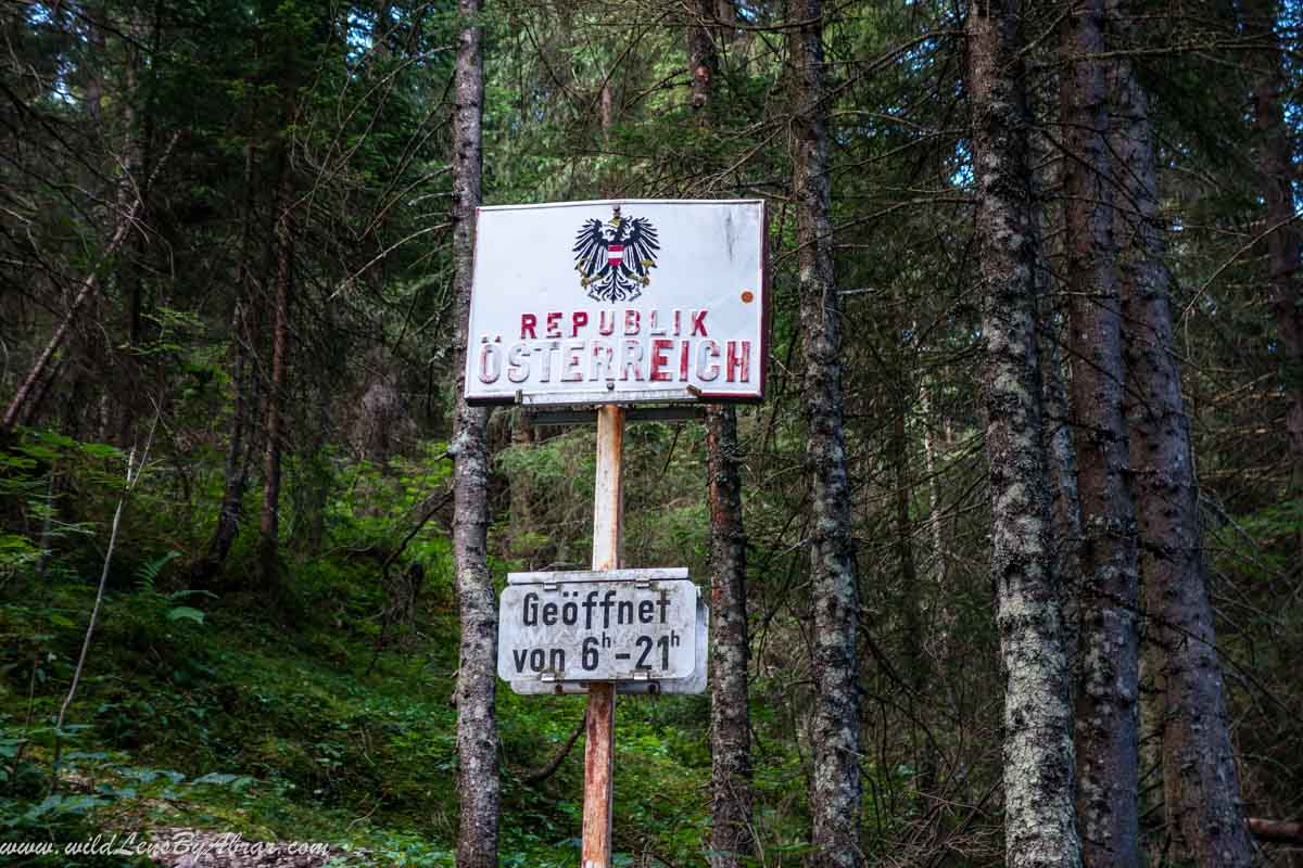
After few minutes of hiking I was at the German-Austrian border
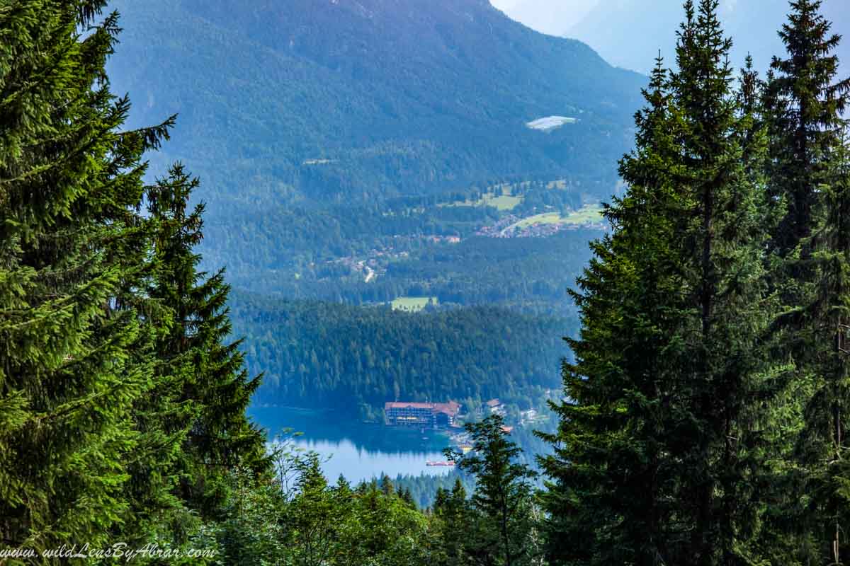
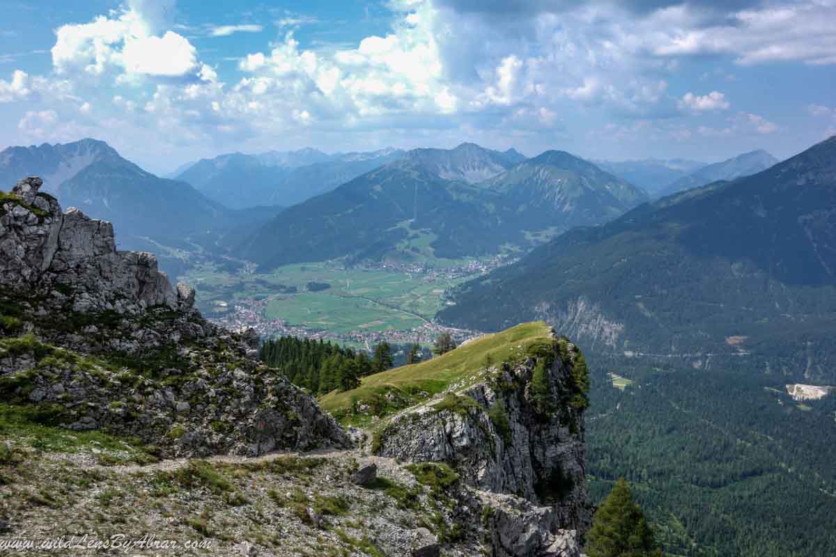
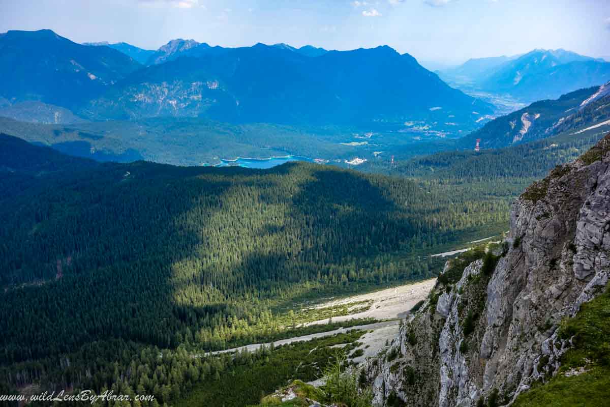
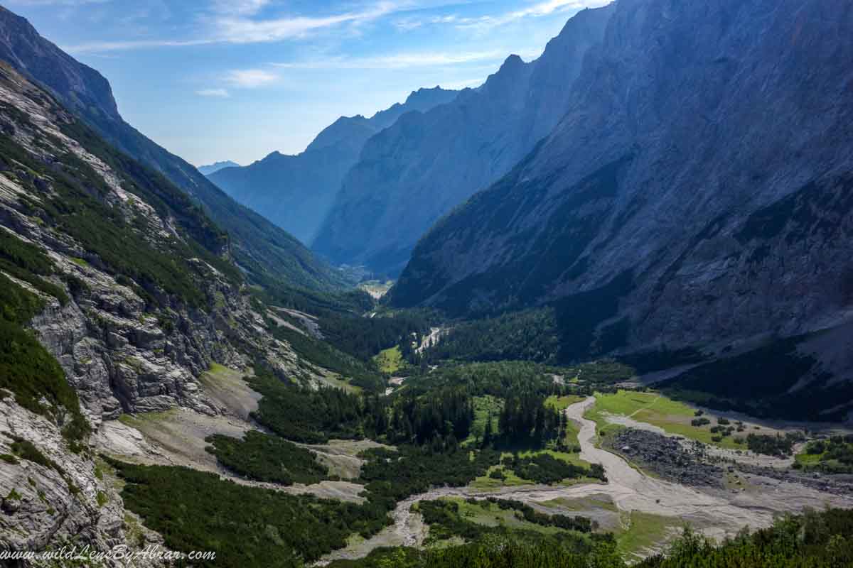
The trail eventually climbs up out of the forest and the views of the surrounding areas are breathtaking
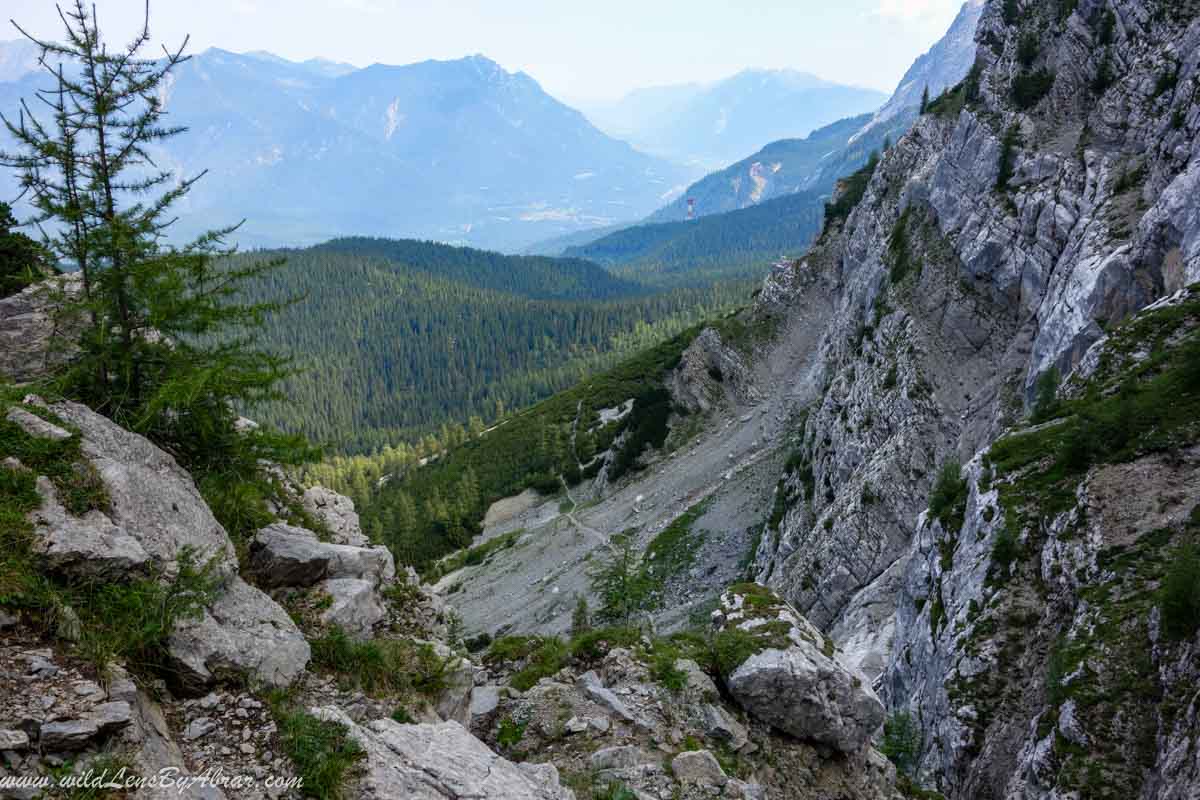
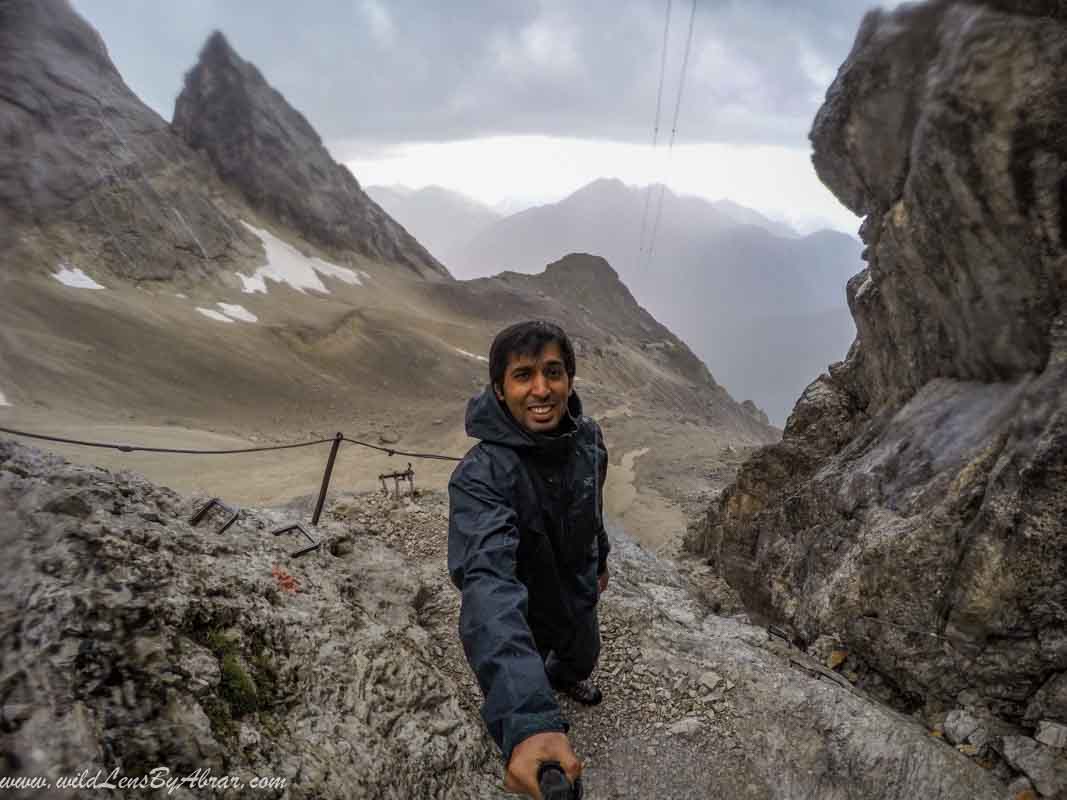
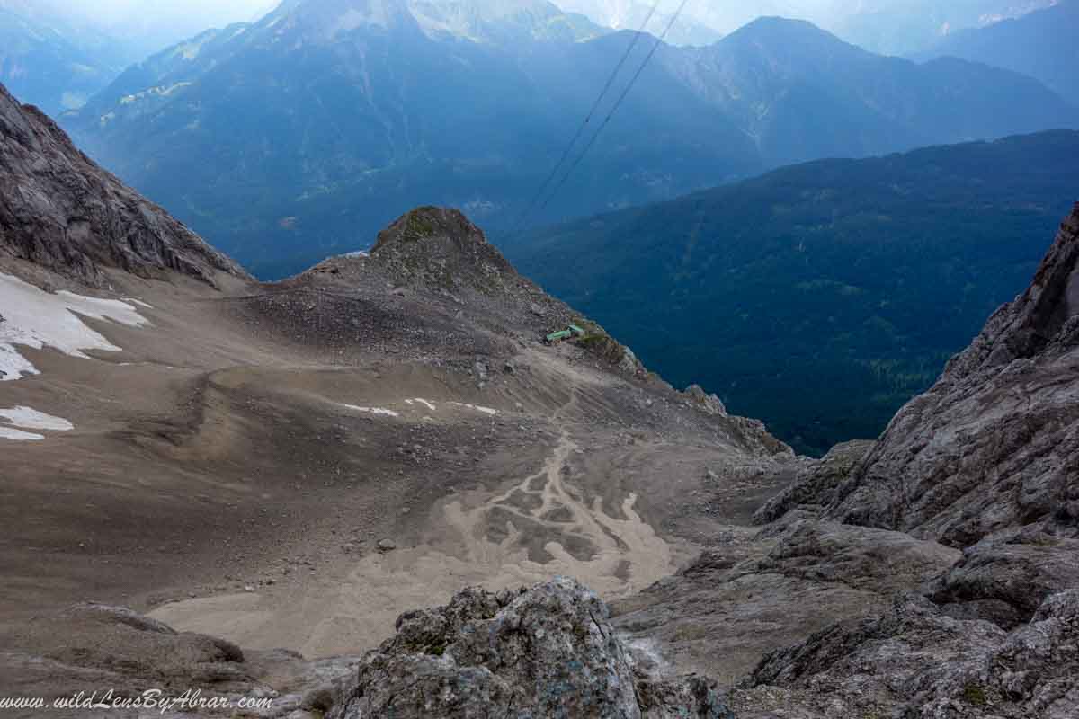
It took me more than 4 hours to reach the Wiener-Neustädter hütte and trail was well marked all along the way. It was very easy to follow. Here are some of the pictures of the trail condition and surrounding areas
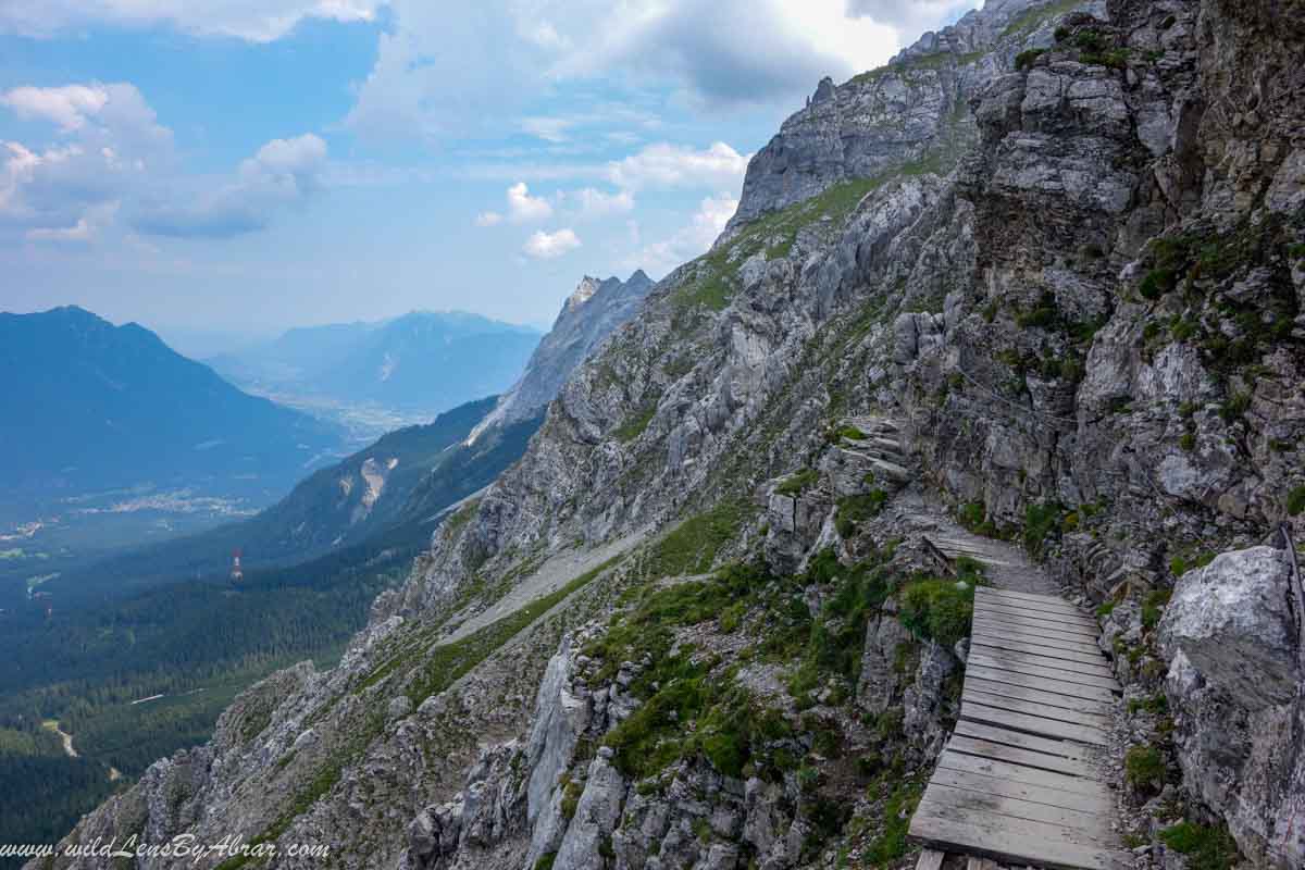
After the Wiener-Neustädter hütte, the trail is steep but easy level climbing. There are fixed ropes and stairs which makes it easy to climb. It is the most strenuous part of the trail and there is a risk of rockfalls especially if you are climbing behind a group.
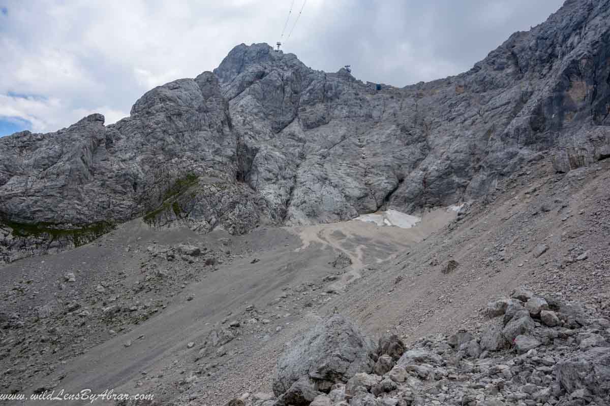
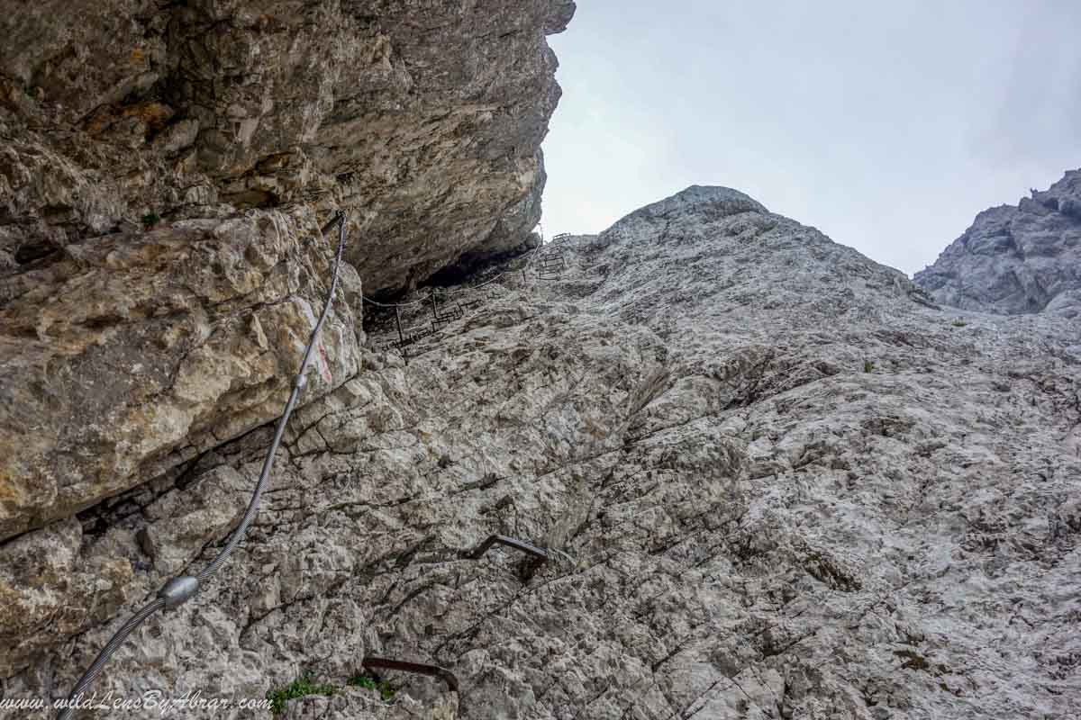
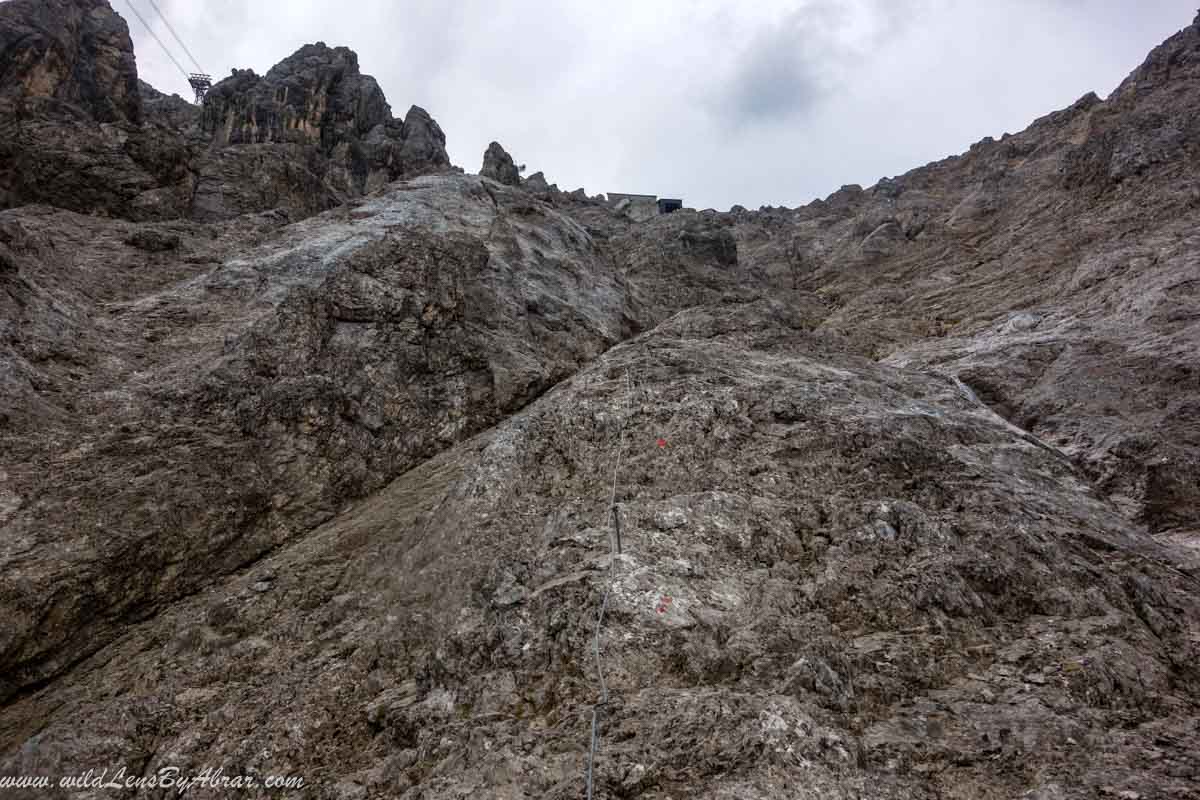
During the summer months, there are frequent thunderstorms in the area especially afternoon and I was unfortunate to face a frightening thunderstorm on the most dangerous part of the trail below the summit. It was not safe to climb in this weather so I waited inside a small cave, stayed there until it was safe to climb again.
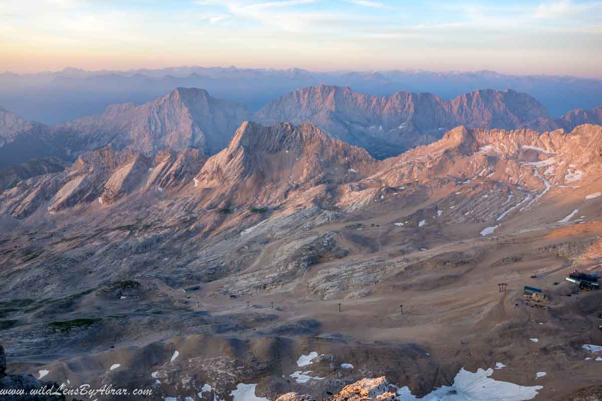
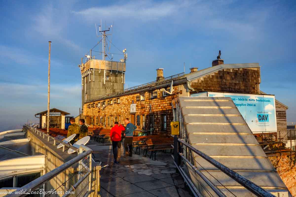
I stayed overnight at the Münchner Haus which is only a couple of meters below the summit and perfect place to stay after such strenuous climb. You can reserve a bed at the hut by either calling them or making an online reservation.
Descend Via Route 1: Reintal
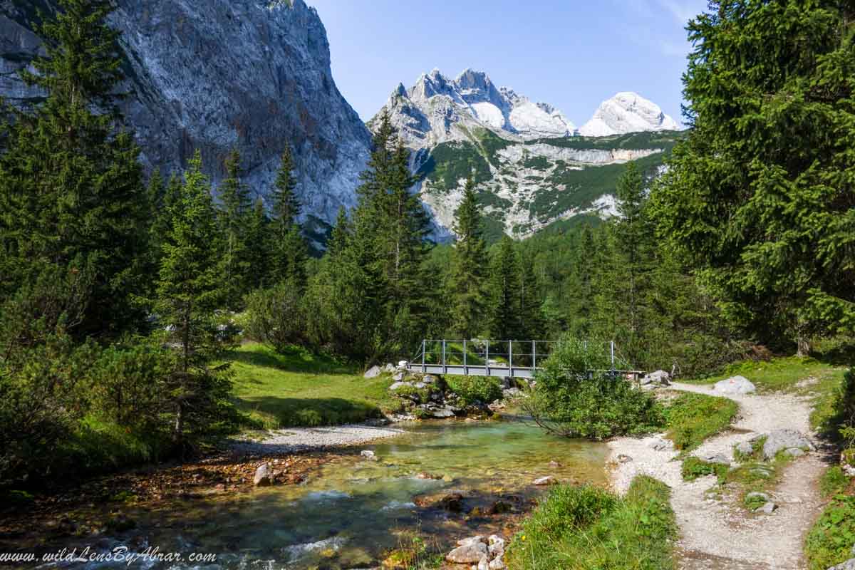
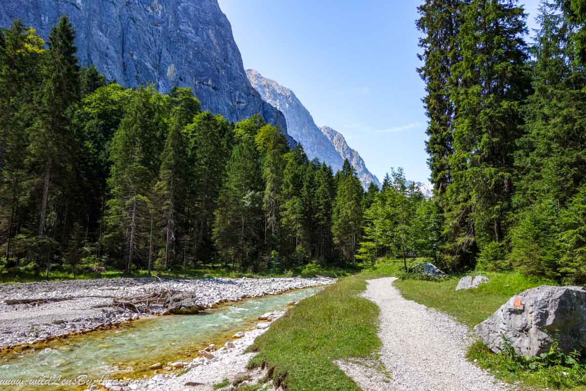
Next day I descended down to Garmisch-Partenkirchen via Reintal which is more scenic and the longest route. It took me around 6 hours to get down to Garmisch-Partenkirchen.
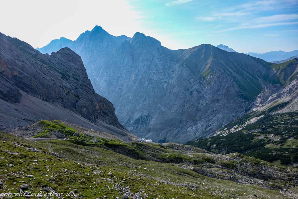
The final part of the Reintal trail is rather flat but long
Pro Tip
If you have no experience in climbing then it's better to choose one of the first three trails according to your abilities. Nevertheless, any trail that you will take, it will be a very long day so either you stay overnight at one of the mountain huts along the trail or descend via cable car. The mountain huts are very crowded on weekends, public holidays and during school holidays so its important to reserve your bed online or by calling them.