WildLens by Abrar
WildLens Blog
Slieve League Cliffs and the Best of Donegal County in One Day
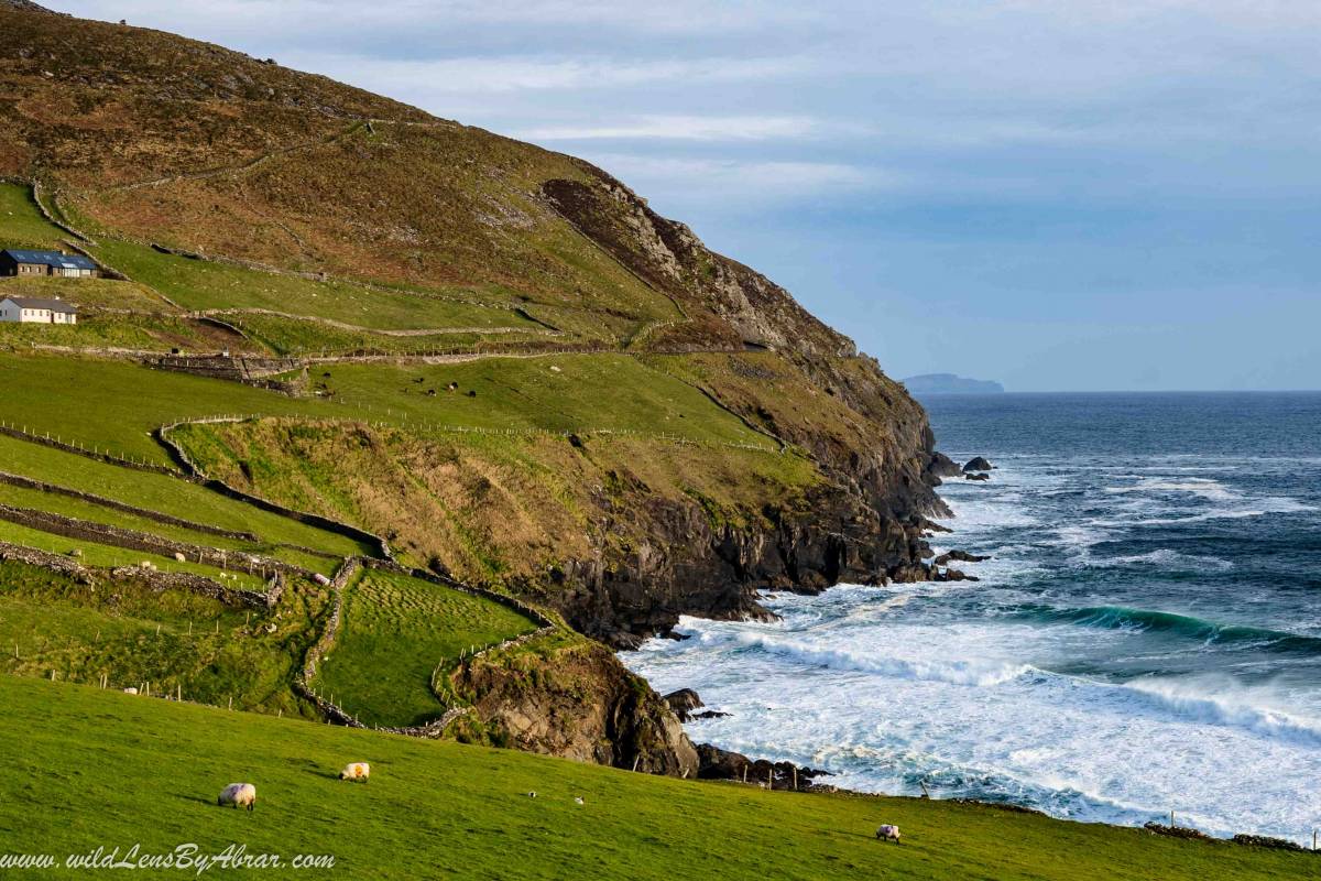
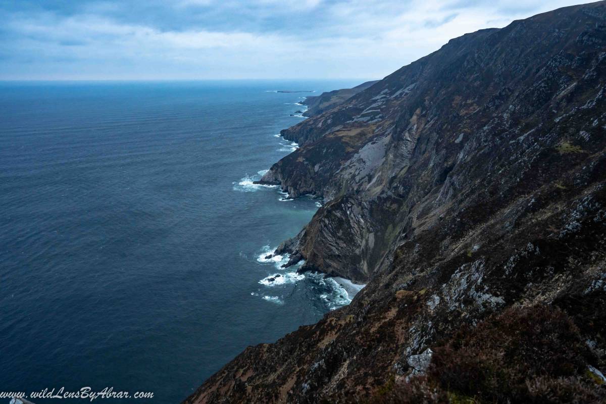
Slieve League cliffs, also known as Sliabh Liag, the highest cliffs in Donegal county, Ireland are considered as the most beautiful cliffs in Europe rising hundreds of meters directly from the Atlantic ocean. The highest point is over 601-meters, making them three times higher than the famous Cliffs of Moher. I spent a day exploring the best places in Donegal along with the impressive Slieve League Cliffs. This blog has all the information that you will need to know before visiting and planning your trip to stunning cliffs of Slieve League.
How to Get to Slieve League Cliffs
Slieve League cliffs are situated on the south-west coast of County Donegal. The best way to get there is by a car (see the below google map for location) and you can stop along the way to see other amazing places which I have described below. Another advantage of driving by yourself is that you can drive all the way up to the small parking at Bunglass point, which is right next to the Slieve league viewing platform.
It is also possible to get here by public transport. There is no direct Bus to Slieve League so first, you have to get a bus to the nearby village of Carrick (check the website of Bus Eireann) and from Carrick, there is a minibus to the cliffs. The minibus leaves from Carrick carpark opposite of Slieve League Bar and Restaurant (for more information go to Discover Ireland website).
Slieve League Cliffs Map
Driving in Donegal - My Experience
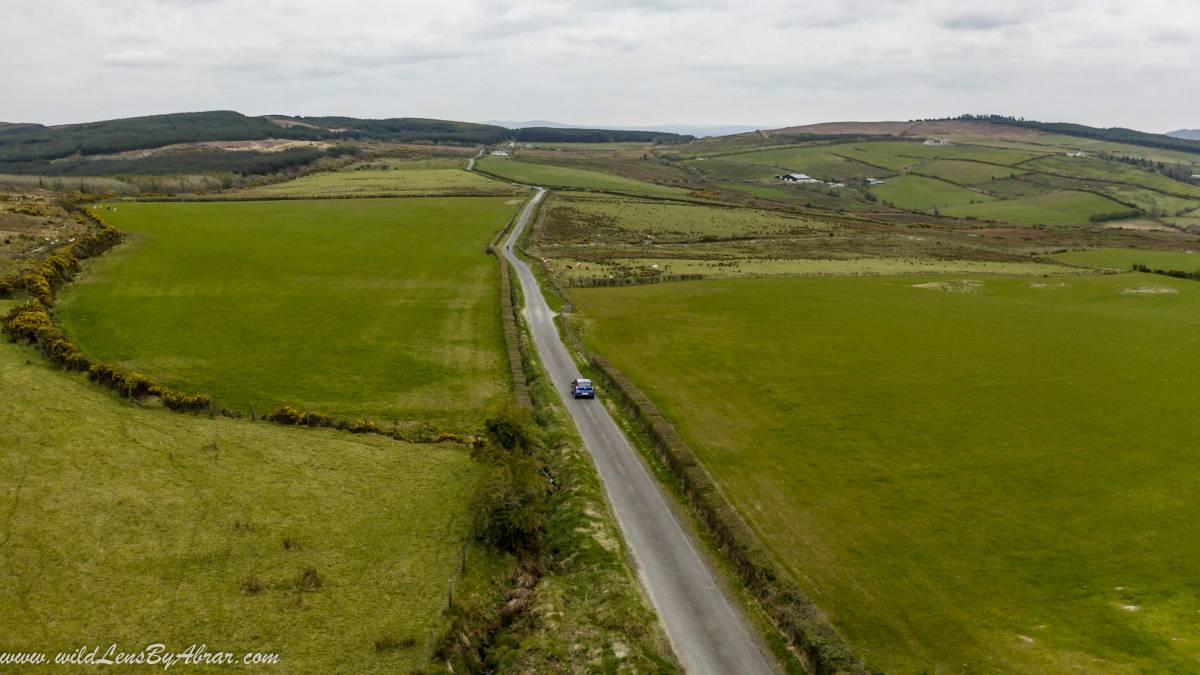
After an overnight stay in Londonderry, I drove in my rental car and left the city around 9 am. It was cloudy and rainy but the main problem was wind with gusts of over 120km/h. I planned to take some stops along the way but the weather hardly allowed me to stop and explore the countryside. Instead of driving directly to Slieve League, I opted for a longer route by passing through Glenveagh National Park, Mount Errigal and Crocknamurrin Mountain Bog (R230 road). This is one of the most beautiful drives in Ireland and shouldn't be missed.
Glenveagh National Park
My first stop was in Glenveagh national park which is absolutely beautiful with numerous hikes and stunning Lough Beagh. Unfortunately, I had awful weather and couldn't do much here. So only stayed here for a brief stop and continued driving.
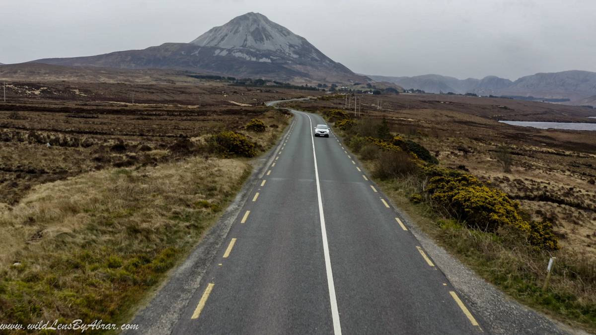
Mount Errigal
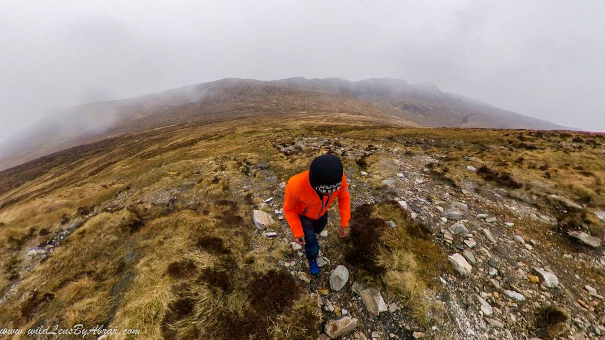
Errigal is a 751-meter mountain in Donegal county which is only a few minutes drive from Glenveagh National Park. There is a parking lot along the main road and the hiking trail is behind the parking. The trail is well trodden and easy to follow. It takes around 1 to 1.5 hours to climb to the top so allow between 2 to 2.5 hours for the round trip.
It was still very windy but I wanted to give it a try to see how far I can go. I met some people along the way and they told me they couldn't reach the top due to strong winds at the exposed ridge which is the only path leading to the top. I didn't want to turn back but I pushed on and upon reaching the exposed ridge, the force of the wind gusts was unbearable to hike on the ridge so, unfortunately, I had to turn back after hiking for only 30minutes.
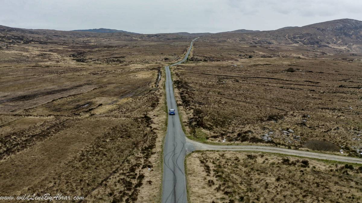
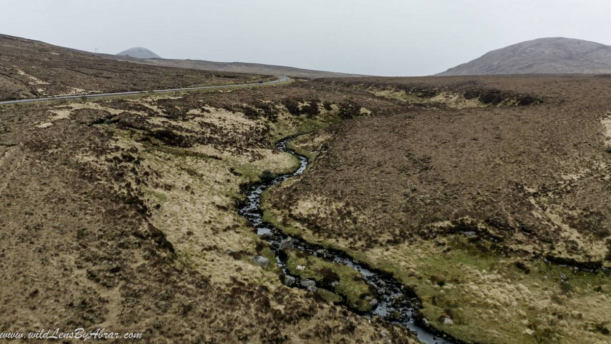
Crocknamurrin Mountain Bog Natural Heritage Area
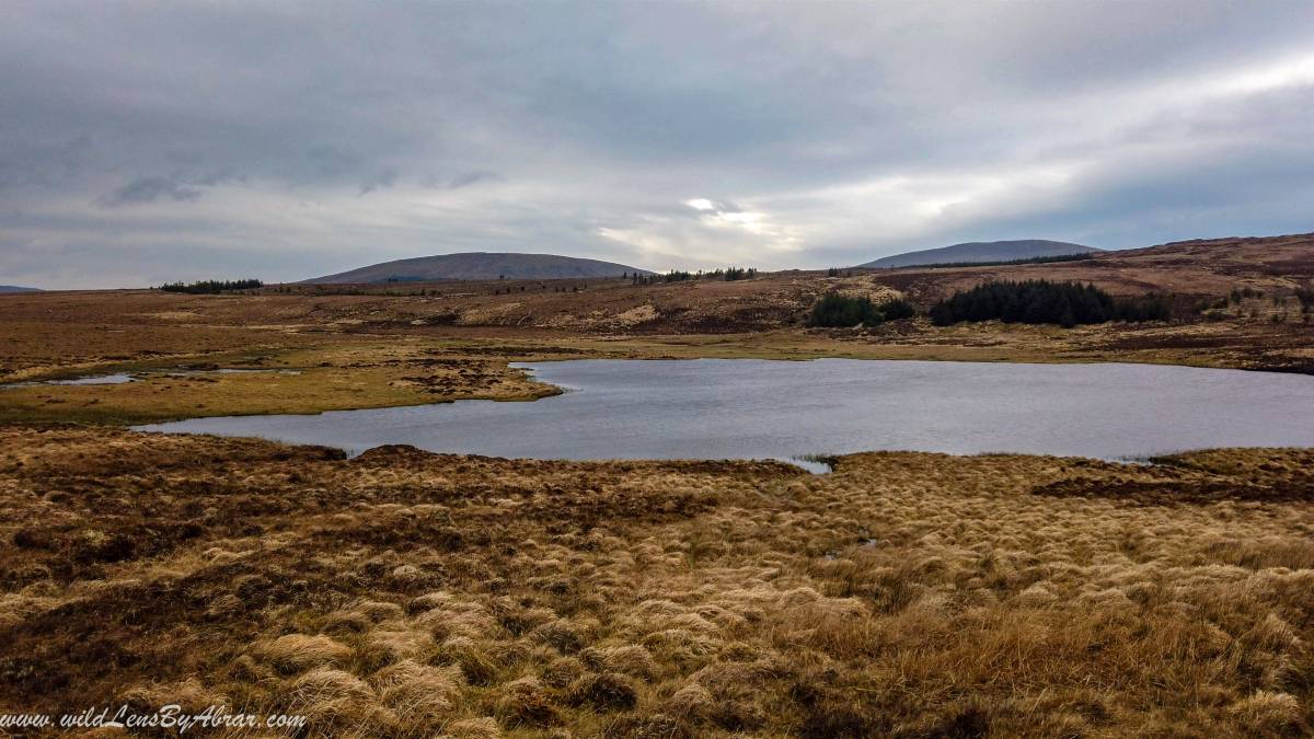
The next couple of hours I spent driving without any break and after passing the town of Ardara I took the small R230 road to Crocknamurrin Mountain Bog which is a Natural Heritage Area with beautiful mountain vistas all around.
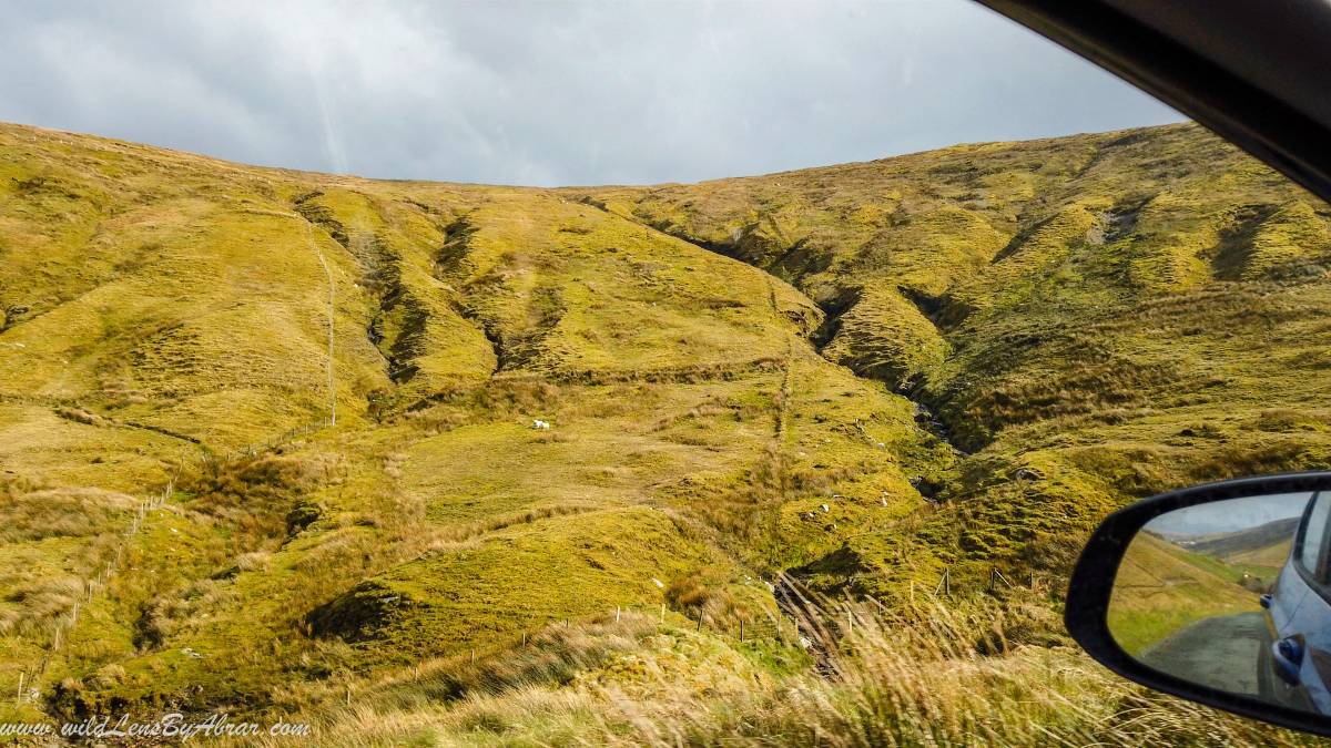
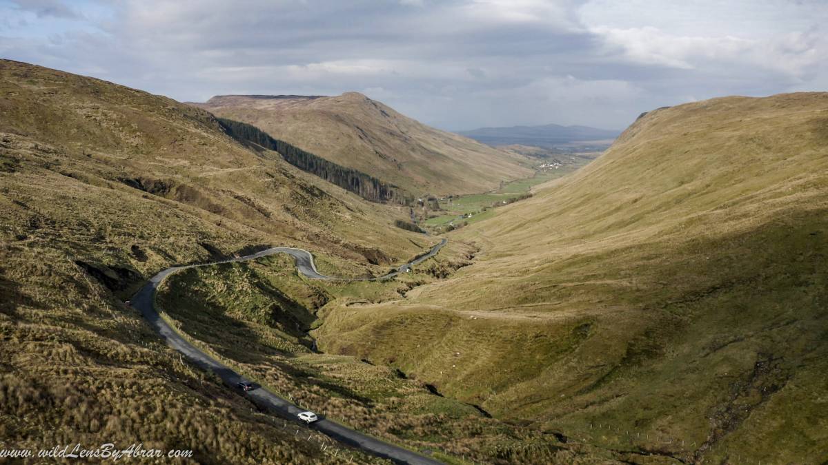
There are a number of lakes and small country roads. The whole area seemed to be private and closed with fences. I couldn't find any proper trek apart from walking on the small roads which are usually used by the farmers. It was absolutely worth driving and walking around.
Slieve League Cliffs Walk
This is probably the most beautiful and one of my favourite places in Ireland. I reached late afternoon at the Slieve League B&B where I had a reservation which is right beside the big parking for the Slieve League visitors. The weather improved in the afternoon and the owner of the B&B advised me to visit the cliffs as weather can change here anytime.
There were almost no cars at the main parking lot and I opened the small gate at the entrance myself to drive all the way up to the viewpoint. There were maybe five or six other tourists and I was very happy to see the place without any crowds.
Slieve League Hiking Trails
The best way to explore the Slieve League cliffs is to hike. There are two hiking paths, one starts from Bunglass point and the other is called The Pilgrim which starts near the village of Teelin. I have marked both points on the above google map.
- Pilgrim's Path is about 3km long and will take you roughly 2-3 hours to complete. You can also walk up the Pilgrim's path and then continue along the cliffs to Bunglass point.
- Bunglass Point is the classic viewpoint of the Slieve League cliffs. Drive past the village of Teelin all the way to the big parking. If you are coming here in offseason, you might be allowed to drive all the way up to the viewpoint which is probably another 1.5km from the main parking lot.
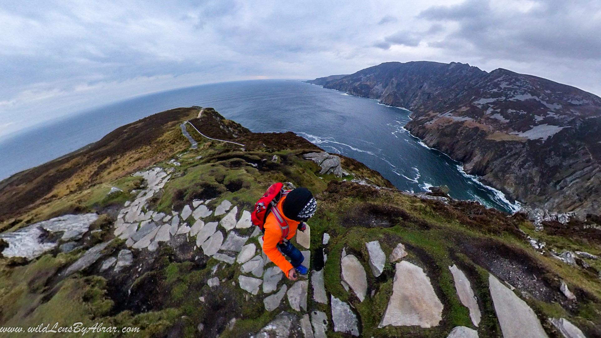
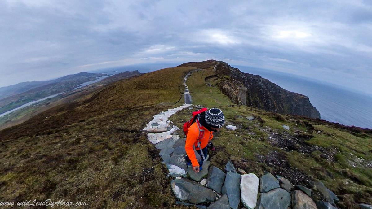
Hiking from Bunglass Point
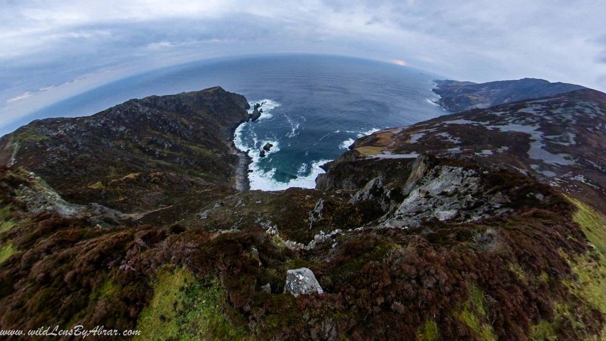
At the Bunglass point is the classic viewing point of the stunning Slieve League cliffs but the views are even better if you walk further on the trail for 20-30minutes. The path is well marked and well made.
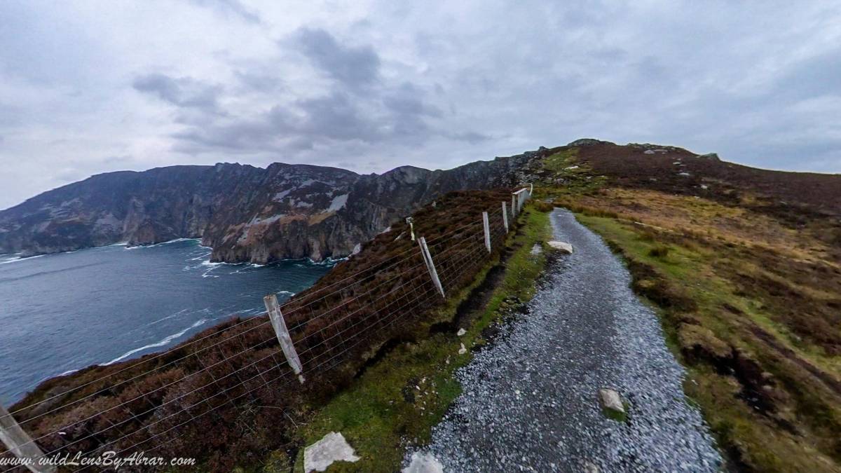
The path in the first section of the hike is in perfect condition. I started the hike from Bunglass point at 8 pm and it took me less than an hour to complete it. The views are out of this world and worth the effort to drive all the way to the cliffs.
After the first section, the path climbs up the cliffs and turns into very muddy and slippery. If you continue further this path will eventually join the Pilgrims path.
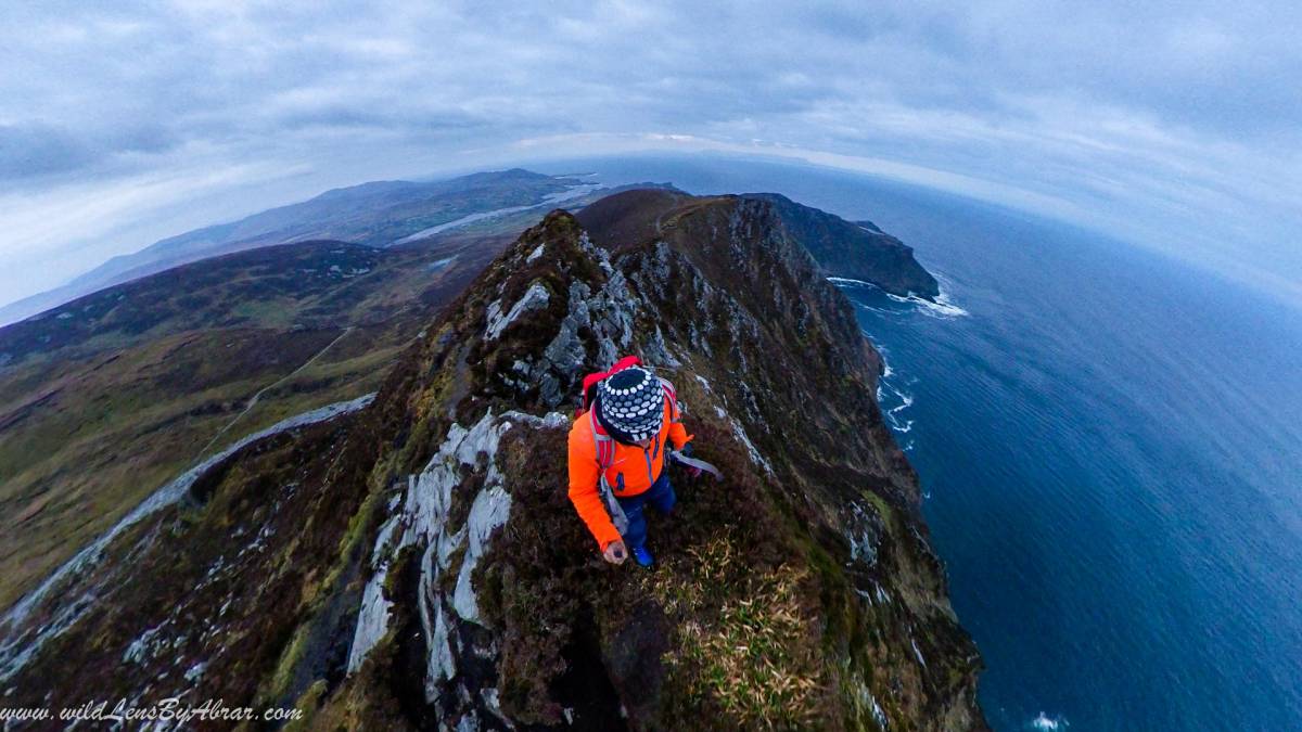
I trekked back from the ridge to the Bunglass point where I parked my car. It took me 2 hours to complete the hike.
Where to Stay Near Slieve League
I stayed overnight in Slieve League B&B for less than 40€ a night and paid 6€ extra for awesome Breakfast. It is very close to the cliffs and the owner was very helpful. I would highly recommend staying here.
It has a kitchen and serves dinner as well. The nearby village of Teelin has an awesome Fish & Chips takeaway served from a Van parked in the parking lot.