WildLens by Abrar
WildLens Blog
How to Hike to Stunning Kvalvika Beach and Ryten Peak in Summer and Winter
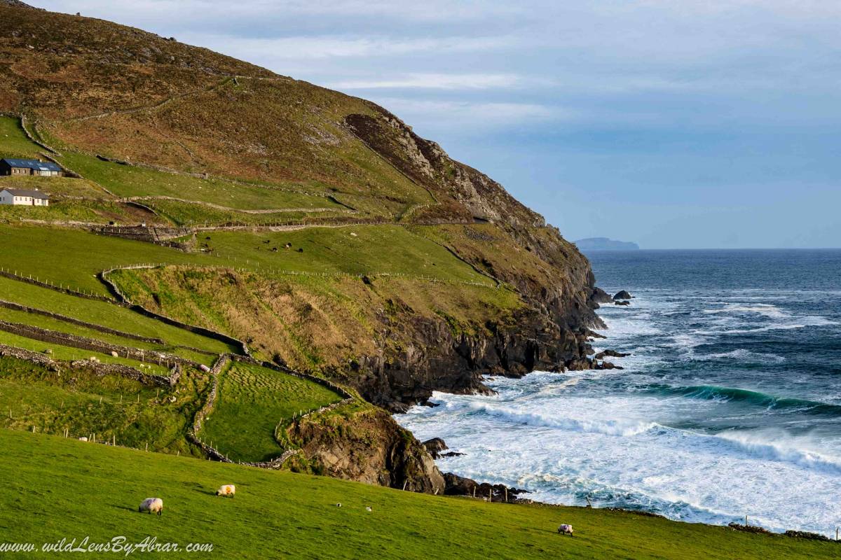
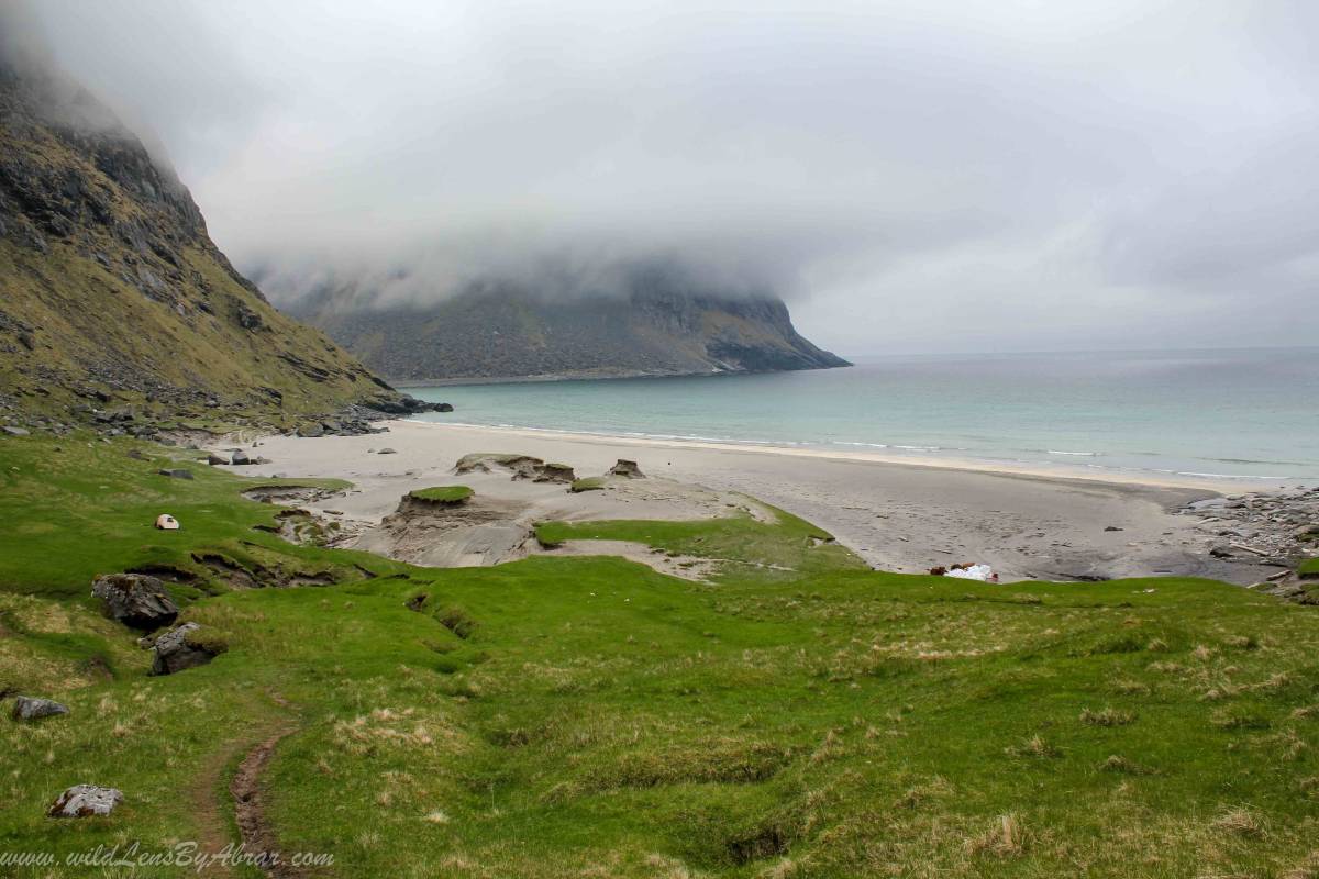
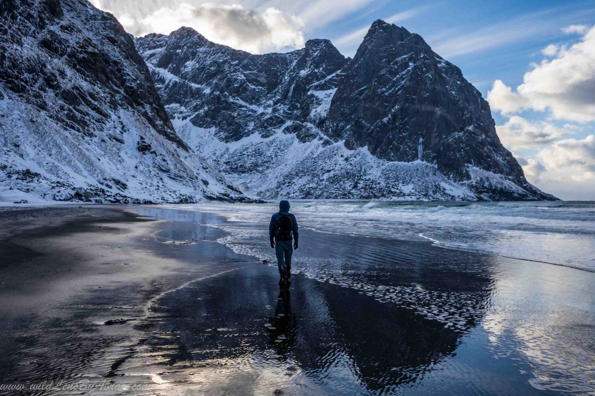
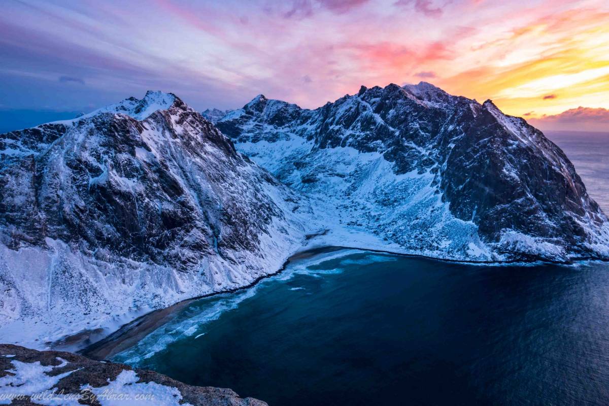
Kvalvika Beach on Lofoten Islands deep inside the Arctic Circle is a gem. Its turquoise water, white soft sand and Jaw-dropping mountain scenery are breathtaking. It is a short and relatively easy hike and the trek is opened all year round. The best views of the beach and surrounding mountains are from the nearby Ryten peak. I have hiked to Kvalvika beach and climbed the Ryten peak during the summer and winter season. In this blog, you will find all the information you need to know about this incredible hike.
How to Get There
Follow the main road E10 in Lofoten from any location towards the village of Fredvang. The village is connected to E10 through beautiful twin bridges. To get to the hiking trail continue driving through the village and after approx. 3km there is a signpost directing towards the trailhead and Parking lot. The parking might be full especially during the high summer season in that case you can park the car in the village. There are two paths and both trailheads are marked on the below google map.
Avoid parking along the road, during the high season police patrol the area and write tickets for illegally parked vehicles which be very expensive.
How to Use This Map: Click the Tab on the Upper left corner of the map to view all places of interest marked in the map. You can show or hide the places by check/uncheck marks. By clicking on the Star in the upper corner next to the name of the map, you can add this map into your Google maps to view it on mobile or computer. It will be saved under "Your Places" under the Menu.
Kvalvika Beach Hike
- Distance: 2 km
- Height: 200meters
- Difficulty: Easy
- Duration: 1 hour
From the parking lot, you will see the signpost to the trail. The old trail had some boggy sections which are replaced with stone steps and a wooden walkaway. It is a relatively easy trail with gentle elevation gain. The path is well marked all along. It took us less than 40minutes to reach the top of the pass overlooking the beach and from there is another 20 minutes hike.
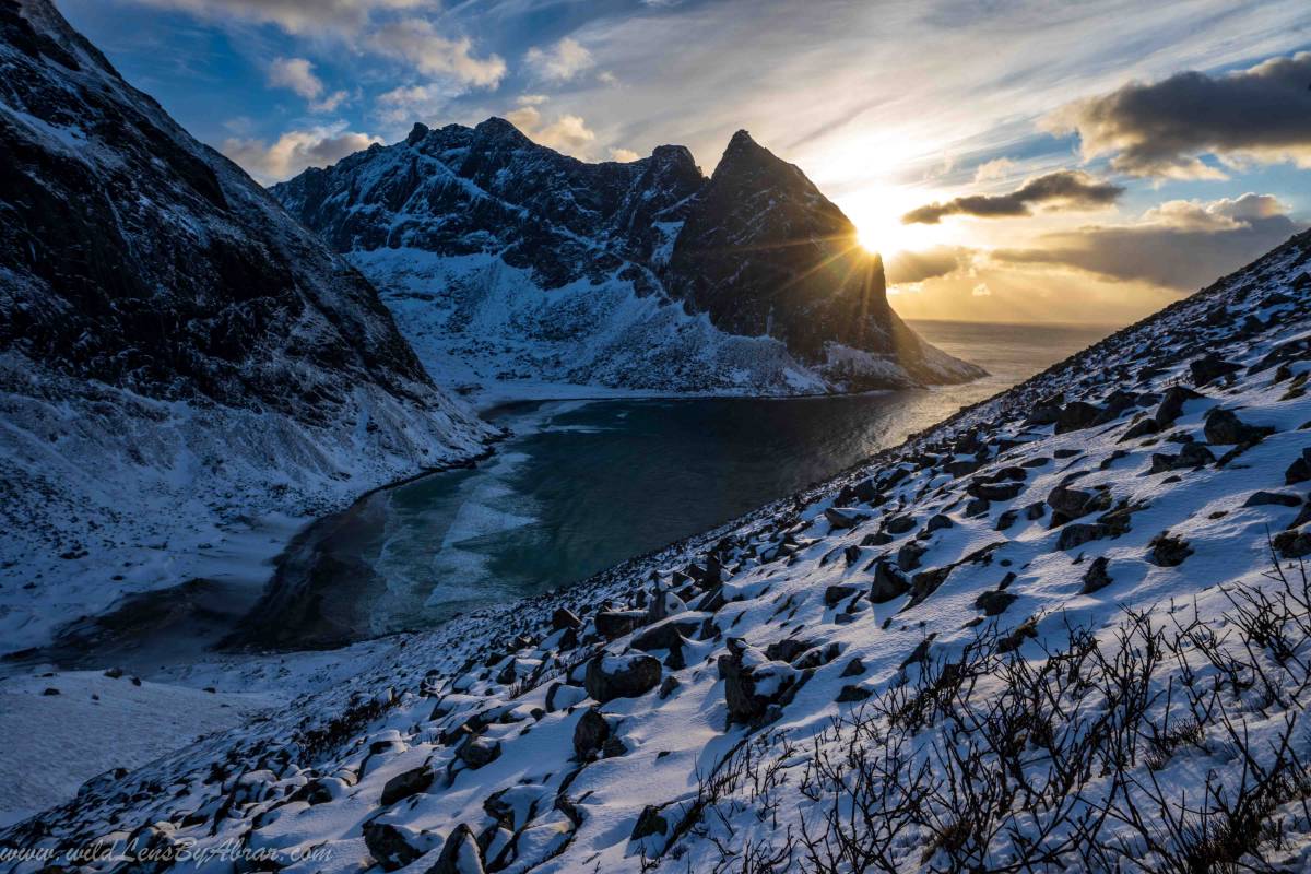
Ryten Peak Hike
- Distance: 3.5 km
- Height: 543meters
- Difficulty: Easy
- Duration: 2-3 hours
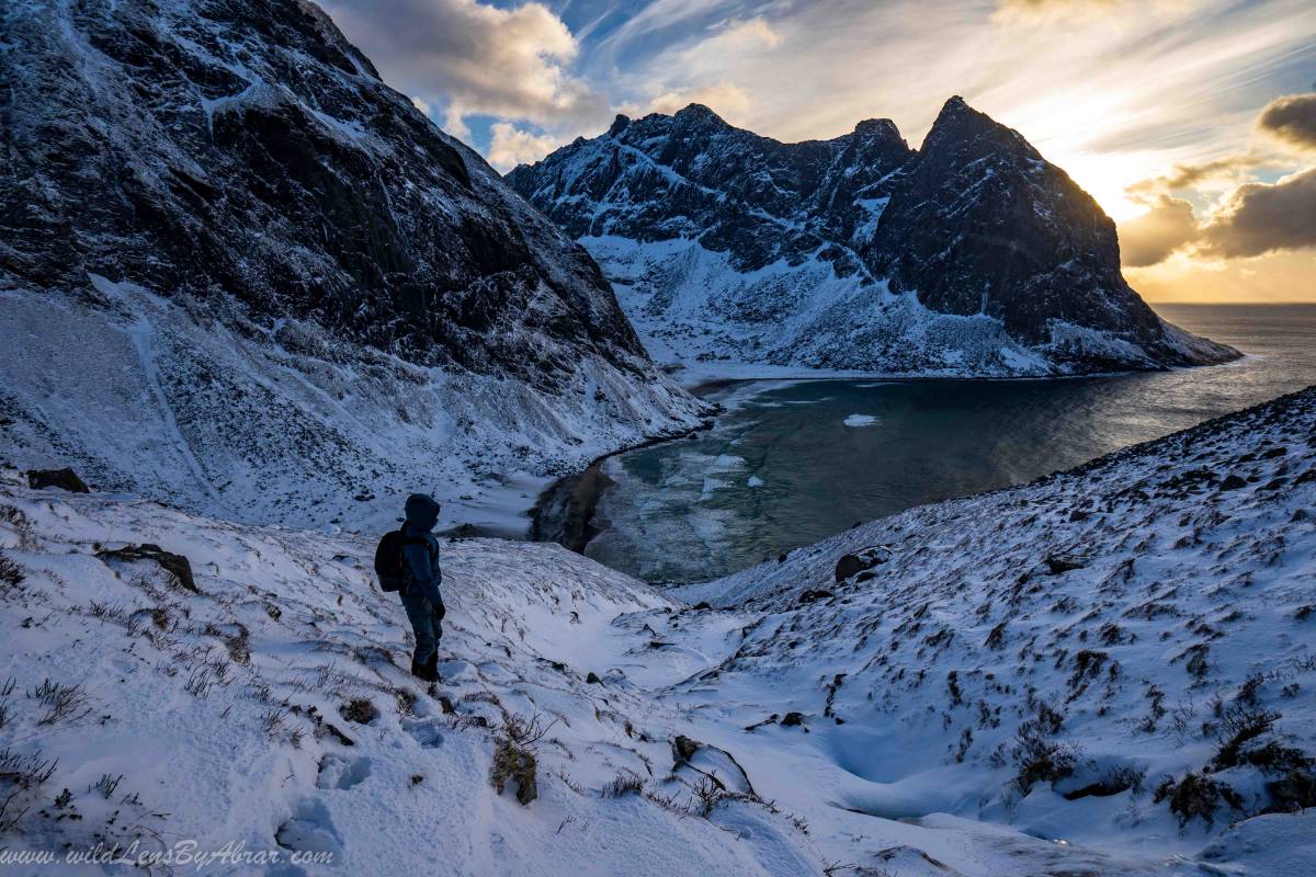
There are two hiking routes to Ryten Peak. One is a direct route marked on the above google map which will take you through beautiful meadows with a gentle climb towards the peak. The second option is to follow the Kvalvika beach trail and from the beach, on the right side, you will notice a steep climbing path (wooden walkaway). Take this and after the steep section, you will reach the lake. From the lake, you will see a path going up to the peak.
During the winter season, the path is usually covered under snow and will be little hard to find. It took us more than an hour to climb the first steep section.
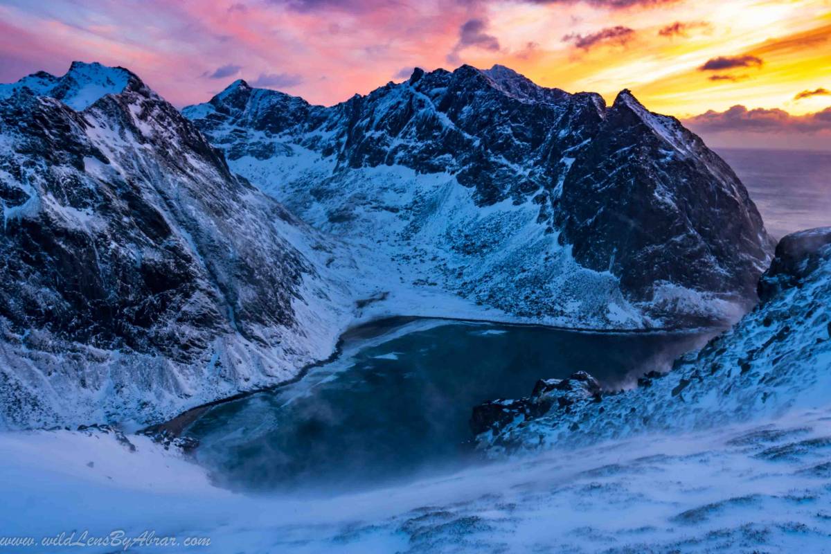
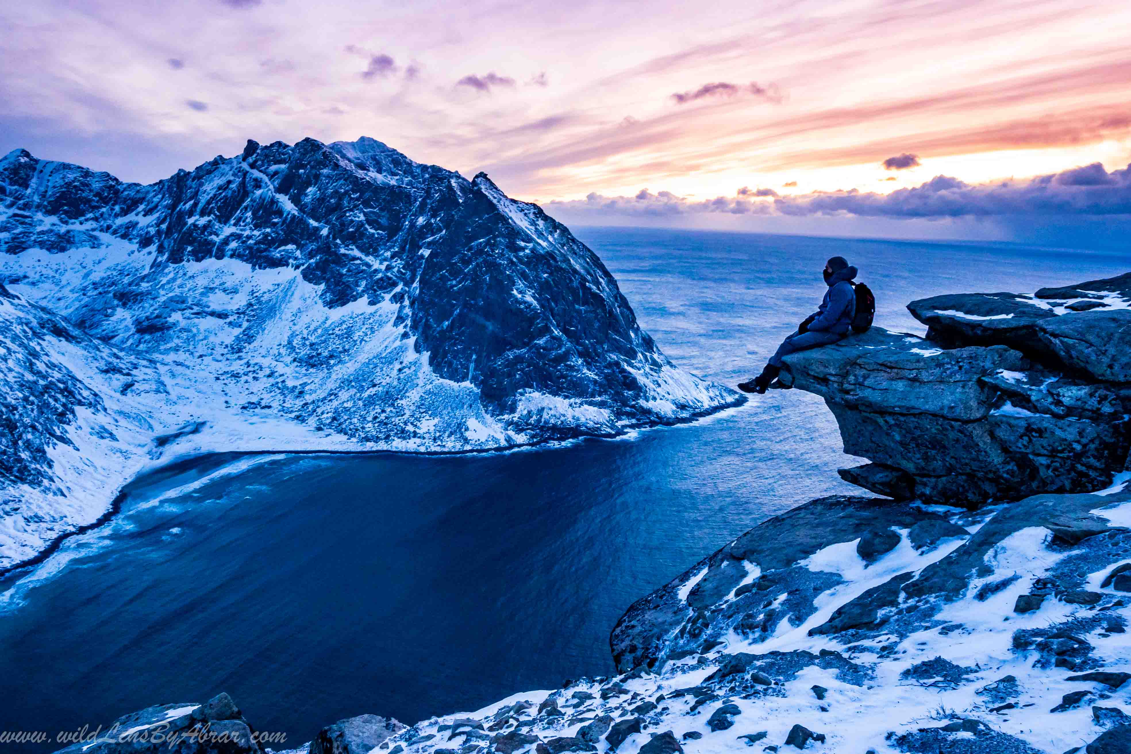
Sunset is the perfect time to be at the top of the Ryten peak and it takes less than an hour to descend. We descended from the peak after the sunset and arrived back just in time before the dark.
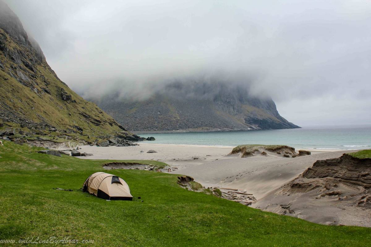
Camping
Camping at the Kvalvika beach is very popular when I visited the beach the first time in 2011 there was only one couple camping but nowadays during the summer season around 30 to 40 tents. There are also some nice camping spots along the Ryten peak trail near the lake and at the top but there is no water. At the Kvalvika beach, water is available from the streams. During the winter season, the streams are frozen.
Read More: How to Hike to Reinebringgen