WildLens by Abrar
WildLens Blog
How to Hike to Sørvágsvatn, The Lake Over the Ocean

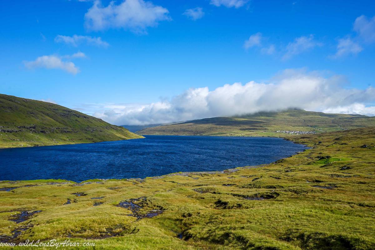
Sørvágsvatn also is known as Leitisvatn, it's a lake on the cliffs over the ocean is one of the most beautiful and popular hikes on the Faroe Islands. This lake is 40 meters above the sea level surrounded by cliffs, it can give the illusion of higher altitude from certain perspectives than it actually is and an easy 2 hours return hike with amazing views.
How to Hike to Sørvágsvatn
The starting point of the trail is a small car park in Miðvágur about 10 minutes drive from the airport, see above google map for the location. The car park, unfortunately, is very small and due to the popularity of the hike, there isn't always enough space for everyone to park.
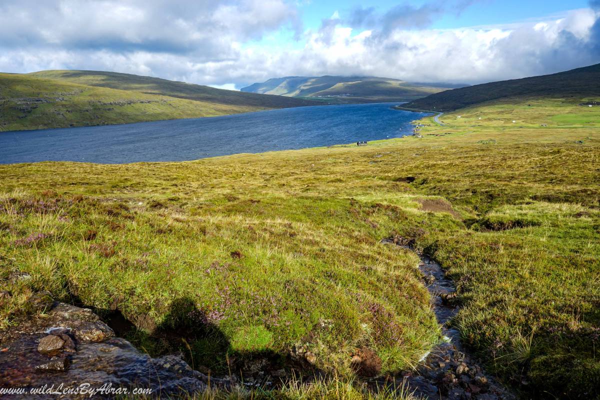
The trail is well made and follows the lake all the way up to the last cliffs near the ocean. The cliffs are visible after hiking only a few minutes from the car park. When we started the hike, it was raining and within a few minutes, it all got cleared up but after about 20 minutes it started to rain again. The weather changes here very quickly. We even saw a guy in his jeans and t-shirt with a camera in his hand going for hiking, it was a big mistake as it started to rain heavily and there was no shelter.
After walking for around 30 minutes, you will reach the viewpoint of the cliffs and the ocean.
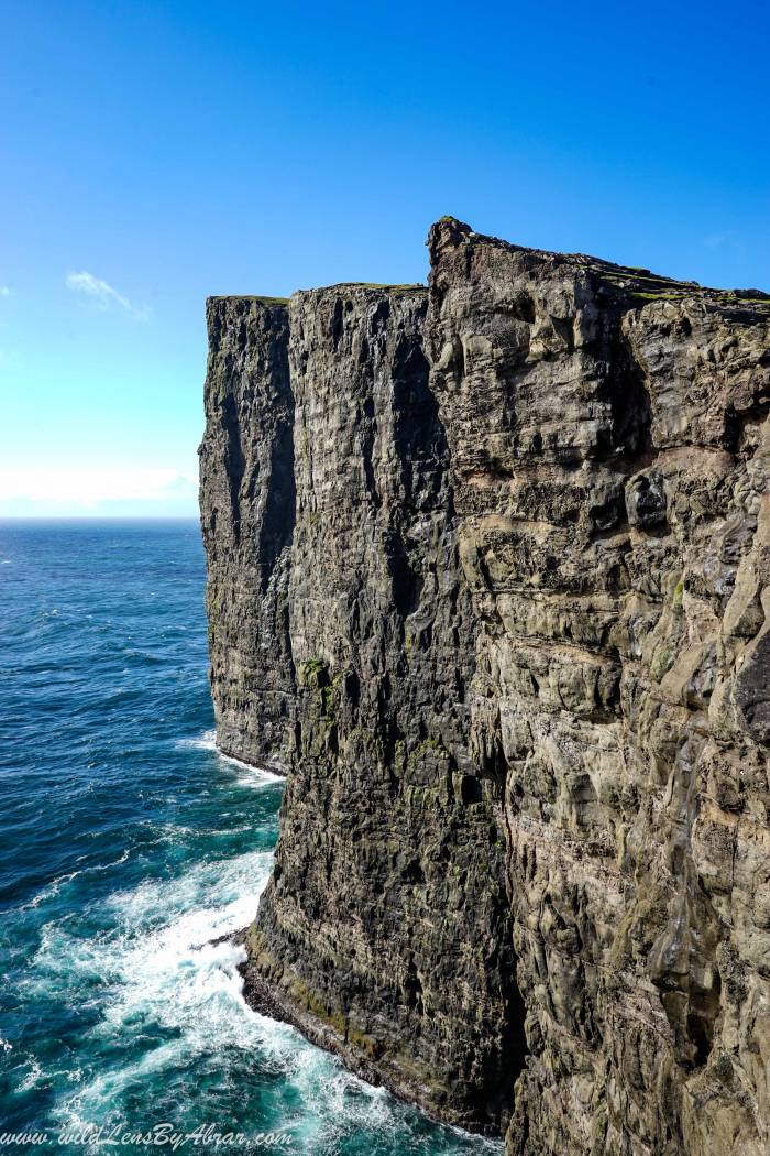
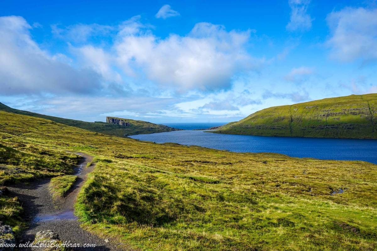
Continue hiking further high up the cliffs to reach the best viewpoint, called Trælanípan, from here you will see the cliffs and the lake. It is a perfect spot for pictures.
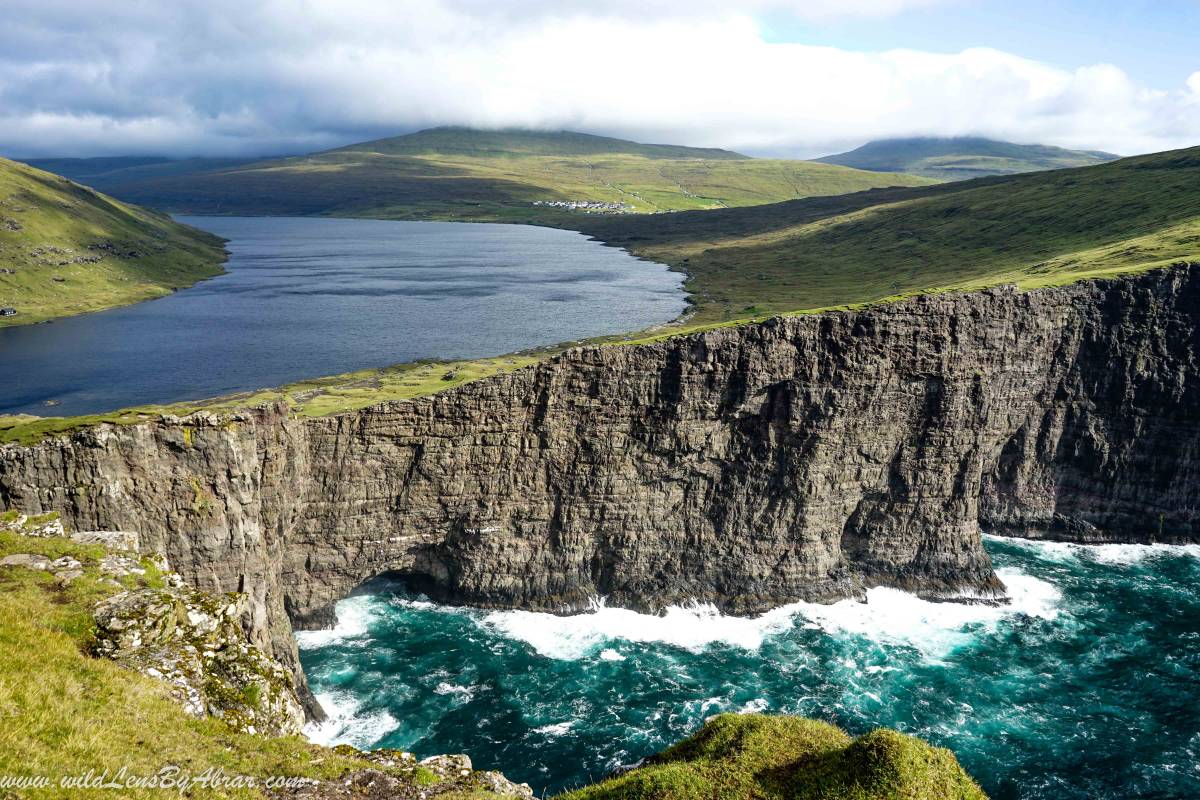
Here, you can also walk to the Bøsdalafossur waterfall, which flows from Sørvágsvatn lake to the Atlantic ocean at a height of 30 meters. Unfortunately for us, It was very windy and it started to rain heavily and we couldn't spend more time there to photograph the waterfall. It took us around 2 hours in total from the car park.
Sørvágsvatn: is it worth hiking?
Sørvágsvatn hike is beautiful with amazing views and the trail is well marked but due to the new rules of paying 200 DKK just to access the trail, it is very expensive. There are many other hikes on the Faroe Islands with much better views and no entrance fee. If money is not the issue for you, then definitely go for the hike, but if you are on a budget, then skip it and find another hike, for example, the hike to Gasadalur has better views and doesn't cost anything.
Where to Stay
We stayed in Sandavágur at Á Giljanes Hostel & Campsite, only 3 km from the trailhead and 8 km from the Vagar airport. It is the only hostel and campsite on Vagar island and offers free Wifi, Kitchen and very nice dining room and lounge to socialize with other travellers. We camped there and used their facilities for 100 DKK per person.